A05A Maple Falls, WA, USA - Earthquake Result Viewer
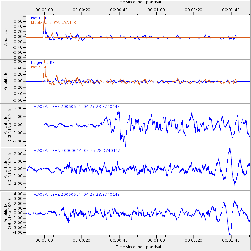
Earthquake location: Rat Islands, Aleutian Islands
Earthquake latitude/longitude: 51.8/177.1
Earthquake time(UTC): 2006/06/14 (165) 04:18:42 GMT
Earthquake Depth: 14 km
Earthquake Magnitude: 5.9 MB, 6.4 MS, 6.4 MW, 6.4 MW
Earthquake Catalog/Contributor: WHDF/NEIC
Network: TA USArray Transportable Network (new EarthScope stations)
Station: A05A Maple Falls, WA, USA
Lat/Lon: 49.00 N/122.09 W
Elevation: 174 m
Distance: 37.9 deg
Az: 69.383 deg
Baz: 297.941 deg
Ray Param: 0.075856626
Estimated Moho Depth: 60.0 km
Estimated Crust Vp/Vs: 1.70
Assumed Crust Vp: 6.566 km/s
Estimated Crust Vs: 3.874 km/s
Estimated Crust Poisson's Ratio: 0.23
Radial Match: 81.734985 %
Radial Bump: 390
Transverse Match: 51.19144 %
Transverse Bump: 400
SOD ConfigId: 5745
Insert Time: 2010-03-06 01:34:15.953 +0000
GWidth: 2.5
Max Bumps: 400
Tol: 0.001

Signal To Noise

ChannelStoNSTALTA
TA:A05A: :BHN:20060614T04:25:28.374014Z1.11645212.1247507E-71.9031275E-7
TA:A05A: :BHE:20060614T04:25:28.374014Z2.04710032.7080193E-71.3228563E-7
TA:A05A: :BHZ:20060614T04:25:28.374014Z3.89716154.95751E-71.2720824E-7
Arrivals
Ps6.9 SECOND
PpPs23 SECOND
PsPs/PpSs30 SECOND