You are here: Home > Network List > TA - USArray Transportable Network (new EarthScope stations) Stations List
> Station R32K Eaglecrest, AK, USA > Earthquake Result Viewer
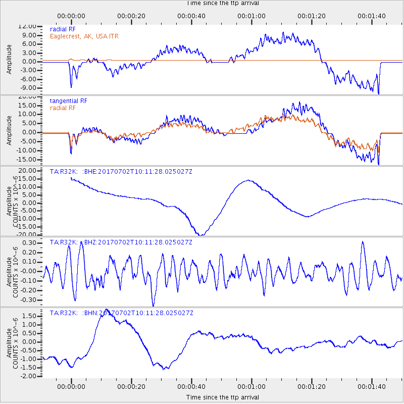
R32K Eaglecrest, AK, USA - Earthquake Result Viewer
*The percent match for this event was below the threshold and hence no stack was calculated.
| Earthquake location: |
Kermadec Islands Region |
| Earthquake latitude/longitude: |
-27.4/-176.5 |
| Earthquake time(UTC): |
2017/07/02 (183) 09:58:50 GMT |
| Earthquake Depth: |
16 km |
| Earthquake Magnitude: |
5.7 Mww |
| Earthquake Catalog/Contributor: |
NEIC PDE/us |
|
| Network: |
TA USArray Transportable Network (new EarthScope stations) |
| Station: |
R32K Eaglecrest, AK, USA |
| Lat/Lon: |
58.27 N/134.52 W |
| Elevation: |
386 m |
|
| Distance: |
92.2 deg |
| Az: |
20.694 deg |
| Baz: |
216.499 deg |
| Ray Param: |
$rayparam |
*The percent match for this event was below the threshold and hence was not used in the summary stack. |
|
| Radial Match: |
29.554855 % |
| Radial Bump: |
400 |
| Transverse Match: |
28.912455 % |
| Transverse Bump: |
400 |
| SOD ConfigId: |
13570011 |
| Insert Time: |
2019-04-28 07:57:30.189 +0000 |
| GWidth: |
2.5 |
| Max Bumps: |
400 |
| Tol: |
0.001 |
|
Signal To Noise
| Channel | StoN | STA | LTA |
| TA:R32K: :BHZ:20170702T10:11:28.025027Z | 4.0909624 | 2.1686196E-7 | 5.3010012E-8 |
| TA:R32K: :BHN:20170702T10:11:28.025027Z | 1.5203532 | 1.173783E-6 | 7.720462E-7 |
| TA:R32K: :BHE:20170702T10:11:28.025027Z | 2.2357788 | 8.500472E-6 | 3.8020185E-6 |
| Arrivals |
| Ps | |
| PpPs | |
| PsPs/PpSs | |


