You are here: Home > Network List > TA - USArray Transportable Network (new EarthScope stations) Stations List
> Station A05A Maple Falls, WA, USA > Earthquake Result Viewer
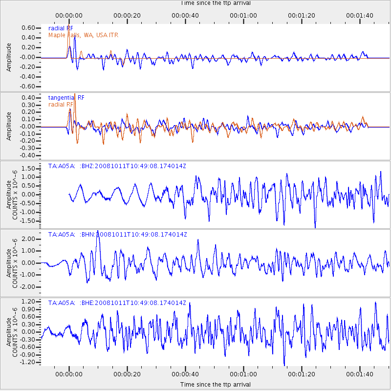
A05A Maple Falls, WA, USA - Earthquake Result Viewer
*The percent match for this event was below the threshold and hence no stack was calculated.
| Earthquake location: |
Virgin Islands |
| Earthquake latitude/longitude: |
19.2/-64.8 |
| Earthquake time(UTC): |
2008/10/11 (285) 10:40:14 GMT |
| Earthquake Depth: |
23 km |
| Earthquake Magnitude: |
6.1 MB, 5.9 MS, 6.1 MW, 6.0 MW |
| Earthquake Catalog/Contributor: |
WHDF/NEIC |
|
| Network: |
TA USArray Transportable Network (new EarthScope stations) |
| Station: |
A05A Maple Falls, WA, USA |
| Lat/Lon: |
49.00 N/122.09 W |
| Elevation: |
174 m |
|
| Distance: |
54.4 deg |
| Az: |
317.053 deg |
| Baz: |
102.064 deg |
| Ray Param: |
$rayparam |
*The percent match for this event was below the threshold and hence was not used in the summary stack. |
|
| Radial Match: |
61.67842 % |
| Radial Bump: |
400 |
| Transverse Match: |
62.054337 % |
| Transverse Bump: |
400 |
| SOD ConfigId: |
2560 |
| Insert Time: |
2010-03-06 01:34:39.337 +0000 |
| GWidth: |
2.5 |
| Max Bumps: |
400 |
| Tol: |
0.001 |
|
Signal To Noise
| Channel | StoN | STA | LTA |
| TA:A05A: :BHN:20081011T10:49:08.174014Z | 5.0647993 | 4.9044166E-7 | 9.6833375E-8 |
| TA:A05A: :BHE:20081011T10:49:08.174014Z | 1.6074003 | 2.256217E-7 | 1.4036435E-7 |
| TA:A05A: :BHZ:20081011T10:49:08.174014Z | 0.84906584 | 2.416677E-7 | 2.8462773E-7 |
| Arrivals |
| Ps | |
| PpPs | |
| PsPs/PpSs | |


