You are here: Home > Network List > TA - USArray Transportable Network (new EarthScope stations) Stations List
> Station A05A Maple Falls, WA, USA > Earthquake Result Viewer
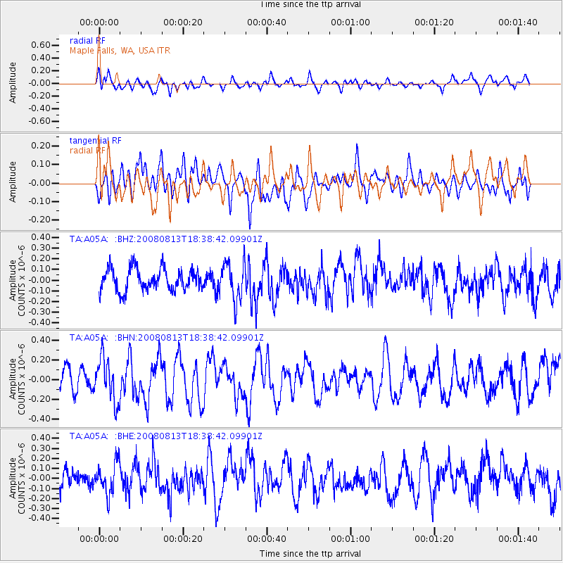
A05A Maple Falls, WA, USA - Earthquake Result Viewer
*The percent match for this event was below the threshold and hence no stack was calculated.
| Earthquake location: |
North Of Severnaya Zemlya |
| Earthquake latitude/longitude: |
83.6/114.5 |
| Earthquake time(UTC): |
2008/08/13 (226) 18:30:57 GMT |
| Earthquake Depth: |
10 km |
| Earthquake Magnitude: |
5.7 MW, 5.2 MS, 5.3 MB, 5.7 MW |
| Earthquake Catalog/Contributor: |
WHDF/NEIC |
|
| Network: |
TA USArray Transportable Network (new EarthScope stations) |
| Station: |
A05A Maple Falls, WA, USA |
| Lat/Lon: |
49.00 N/122.09 W |
| Elevation: |
174 m |
|
| Distance: |
45.0 deg |
| Az: |
50.996 deg |
| Baz: |
352.332 deg |
| Ray Param: |
$rayparam |
*The percent match for this event was below the threshold and hence was not used in the summary stack. |
|
| Radial Match: |
55.31734 % |
| Radial Bump: |
400 |
| Transverse Match: |
59.647514 % |
| Transverse Bump: |
400 |
| SOD ConfigId: |
2504 |
| Insert Time: |
2010-03-06 01:34:45.334 +0000 |
| GWidth: |
2.5 |
| Max Bumps: |
400 |
| Tol: |
0.001 |
|
Signal To Noise
| Channel | StoN | STA | LTA |
| TA:A05A: :BHN:20080813T18:38:42.09901Z | 2.0057492 | 2.2644069E-7 | 1.1289582E-7 |
| TA:A05A: :BHE:20080813T18:38:42.09901Z | 1.2552636 | 1.580008E-7 | 1.2587061E-7 |
| TA:A05A: :BHZ:20080813T18:38:42.09901Z | 1.7590003 | 1.7850334E-7 | 1.0148E-7 |
| Arrivals |
| Ps | |
| PpPs | |
| PsPs/PpSs | |


