You are here: Home > Network List > TA - USArray Transportable Network (new EarthScope stations) Stations List
> Station O18K Koktuh Hills, AK, USA > Earthquake Result Viewer
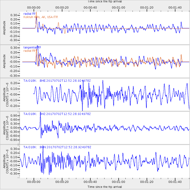
O18K Koktuh Hills, AK, USA - Earthquake Result Viewer
*The percent match for this event was below the threshold and hence no stack was calculated.
| Earthquake location: |
Kermadec Islands Region |
| Earthquake latitude/longitude: |
-27.4/-176.1 |
| Earthquake time(UTC): |
2017/07/02 (183) 12:40:05 GMT |
| Earthquake Depth: |
10 km |
| Earthquake Magnitude: |
5.5 Mww |
| Earthquake Catalog/Contributor: |
NEIC PDE/us |
|
| Network: |
TA USArray Transportable Network (new EarthScope stations) |
| Station: |
O18K Koktuh Hills, AK, USA |
| Lat/Lon: |
59.85 N/155.21 W |
| Elevation: |
544 m |
|
| Distance: |
88.6 deg |
| Az: |
10.364 deg |
| Baz: |
198.47 deg |
| Ray Param: |
$rayparam |
*The percent match for this event was below the threshold and hence was not used in the summary stack. |
|
| Radial Match: |
51.6451 % |
| Radial Bump: |
400 |
| Transverse Match: |
59.486584 % |
| Transverse Bump: |
400 |
| SOD ConfigId: |
13570011 |
| Insert Time: |
2019-04-28 08:03:42.274 +0000 |
| GWidth: |
2.5 |
| Max Bumps: |
400 |
| Tol: |
0.001 |
|
Signal To Noise
| Channel | StoN | STA | LTA |
| TA:O18K: :BHZ:20170702T12:52:28.924978Z | 3.7767818 | 2.9686092E-7 | 7.860155E-8 |
| TA:O18K: :BHN:20170702T12:52:28.924978Z | 1.0078773 | 7.405649E-8 | 7.3477686E-8 |
| TA:O18K: :BHE:20170702T12:52:28.924978Z | 0.8617249 | 7.329718E-8 | 8.505868E-8 |
| Arrivals |
| Ps | |
| PpPs | |
| PsPs/PpSs | |


