You are here: Home > Network List > TA - USArray Transportable Network (new EarthScope stations) Stations List
> Station A05A Maple Falls, WA, USA > Earthquake Result Viewer
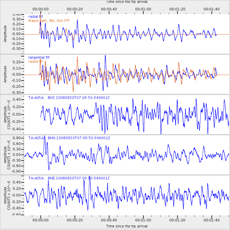
A05A Maple Falls, WA, USA - Earthquake Result Viewer
*The percent match for this event was below the threshold and hence no stack was calculated.
| Earthquake location: |
Eastern New Guinea Reg., P.N.G. |
| Earthquake latitude/longitude: |
-6.1/147.3 |
| Earthquake time(UTC): |
2008/08/30 (243) 06:54:07 GMT |
| Earthquake Depth: |
75 km |
| Earthquake Magnitude: |
6.1 MB, 6.4 MW, 6.3 MW |
| Earthquake Catalog/Contributor: |
WHDF/NEIC |
|
| Network: |
TA USArray Transportable Network (new EarthScope stations) |
| Station: |
A05A Maple Falls, WA, USA |
| Lat/Lon: |
49.00 N/122.09 W |
| Elevation: |
174 m |
|
| Distance: |
95.0 deg |
| Az: |
41.383 deg |
| Baz: |
266.462 deg |
| Ray Param: |
$rayparam |
*The percent match for this event was below the threshold and hence was not used in the summary stack. |
|
| Radial Match: |
64.67293 % |
| Radial Bump: |
400 |
| Transverse Match: |
65.34357 % |
| Transverse Bump: |
400 |
| SOD ConfigId: |
2504 |
| Insert Time: |
2010-03-06 01:35:31.280 +0000 |
| GWidth: |
2.5 |
| Max Bumps: |
400 |
| Tol: |
0.001 |
|
Signal To Noise
| Channel | StoN | STA | LTA |
| TA:A05A: :BHN:20080830T07:06:50.649001Z | 3.6449766 | 4.4820464E-7 | 1.2296503E-7 |
| TA:A05A: :BHE:20080830T07:06:50.649001Z | 2.0924525 | 1.923203E-7 | 9.1911424E-8 |
| TA:A05A: :BHZ:20080830T07:06:50.649001Z | 1.0171113 | 1.4006173E-7 | 1.3770541E-7 |
| Arrivals |
| Ps | |
| PpPs | |
| PsPs/PpSs | |


