You are here: Home > Network List > TA - USArray Transportable Network (new EarthScope stations) Stations List
> Station A05A Maple Falls, WA, USA > Earthquake Result Viewer
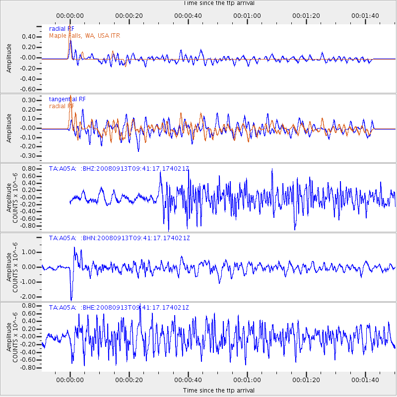
A05A Maple Falls, WA, USA - Earthquake Result Viewer
*The percent match for this event was below the threshold and hence no stack was calculated.
| Earthquake location: |
Colombia |
| Earthquake latitude/longitude: |
4.8/-75.5 |
| Earthquake time(UTC): |
2008/09/13 (257) 09:32:01 GMT |
| Earthquake Depth: |
133 km |
| Earthquake Magnitude: |
5.9 MB, 5.7 MW, 5.7 MW |
| Earthquake Catalog/Contributor: |
WHDF/NEIC |
|
| Network: |
TA USArray Transportable Network (new EarthScope stations) |
| Station: |
A05A Maple Falls, WA, USA |
| Lat/Lon: |
49.00 N/122.09 W |
| Elevation: |
174 m |
|
| Distance: |
59.1 deg |
| Az: |
326.123 deg |
| Baz: |
122.494 deg |
| Ray Param: |
$rayparam |
*The percent match for this event was below the threshold and hence was not used in the summary stack. |
|
| Radial Match: |
59.45244 % |
| Radial Bump: |
400 |
| Transverse Match: |
65.85522 % |
| Transverse Bump: |
400 |
| SOD ConfigId: |
2560 |
| Insert Time: |
2010-03-06 01:35:36.181 +0000 |
| GWidth: |
2.5 |
| Max Bumps: |
400 |
| Tol: |
0.001 |
|
Signal To Noise
| Channel | StoN | STA | LTA |
| TA:A05A: :BHN:20080913T09:41:17.174021Z | 10.257201 | 8.9707754E-7 | 8.745831E-8 |
| TA:A05A: :BHE:20080913T09:41:17.174021Z | 2.8483799 | 3.057247E-7 | 1.07332845E-7 |
| TA:A05A: :BHZ:20080913T09:41:17.174021Z | 3.3702471 | 3.546442E-7 | 1.0522794E-7 |
| Arrivals |
| Ps | |
| PpPs | |
| PsPs/PpSs | |


