You are here: Home > Network List > TA - USArray Transportable Network (new EarthScope stations) Stations List
> Station A05A Maple Falls, WA, USA > Earthquake Result Viewer
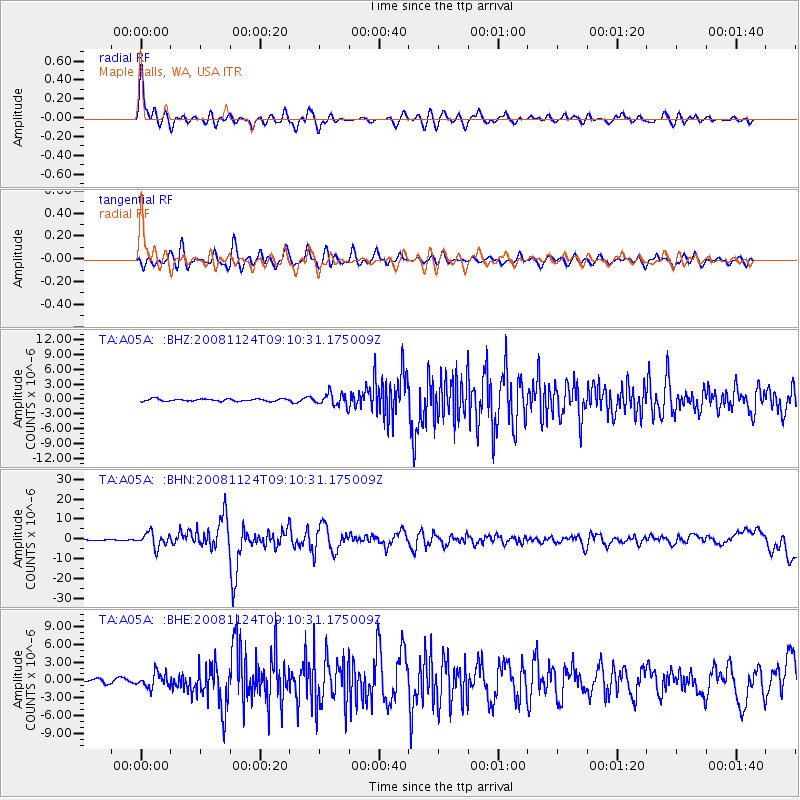
A05A Maple Falls, WA, USA - Earthquake Result Viewer
*The percent match for this event was below the threshold and hence no stack was calculated.
| Earthquake location: |
Sea Of Okhotsk |
| Earthquake latitude/longitude: |
54.2/154.3 |
| Earthquake time(UTC): |
2008/11/24 (329) 09:02:58 GMT |
| Earthquake Depth: |
492 km |
| Earthquake Magnitude: |
6.5 MB, 7.3 MW, 7.3 MW |
| Earthquake Catalog/Contributor: |
WHDF/NEIC |
|
| Network: |
TA USArray Transportable Network (new EarthScope stations) |
| Station: |
A05A Maple Falls, WA, USA |
| Lat/Lon: |
49.00 N/122.09 W |
| Elevation: |
174 m |
|
| Distance: |
49.3 deg |
| Az: |
59.688 deg |
| Baz: |
309.636 deg |
| Ray Param: |
$rayparam |
*The percent match for this event was below the threshold and hence was not used in the summary stack. |
|
| Radial Match: |
74.909805 % |
| Radial Bump: |
400 |
| Transverse Match: |
69.05773 % |
| Transverse Bump: |
400 |
| SOD ConfigId: |
2658 |
| Insert Time: |
2010-03-06 01:35:43.440 +0000 |
| GWidth: |
2.5 |
| Max Bumps: |
400 |
| Tol: |
0.001 |
|
Signal To Noise
| Channel | StoN | STA | LTA |
| TA:A05A: :BHN:20081124T09:10:31.175009Z | 13.224955 | 3.6058375E-6 | 2.7265406E-7 |
| TA:A05A: :BHE:20081124T09:10:31.175009Z | 2.8232439 | 1.207331E-6 | 4.2763966E-7 |
| TA:A05A: :BHZ:20081124T09:10:31.175009Z | 5.4255743 | 1.2543954E-6 | 2.3120047E-7 |
| Arrivals |
| Ps | |
| PpPs | |
| PsPs/PpSs | |


