You are here: Home > Network List > TA - USArray Transportable Network (new EarthScope stations) Stations List
> Station A05A Maple Falls, WA, USA > Earthquake Result Viewer
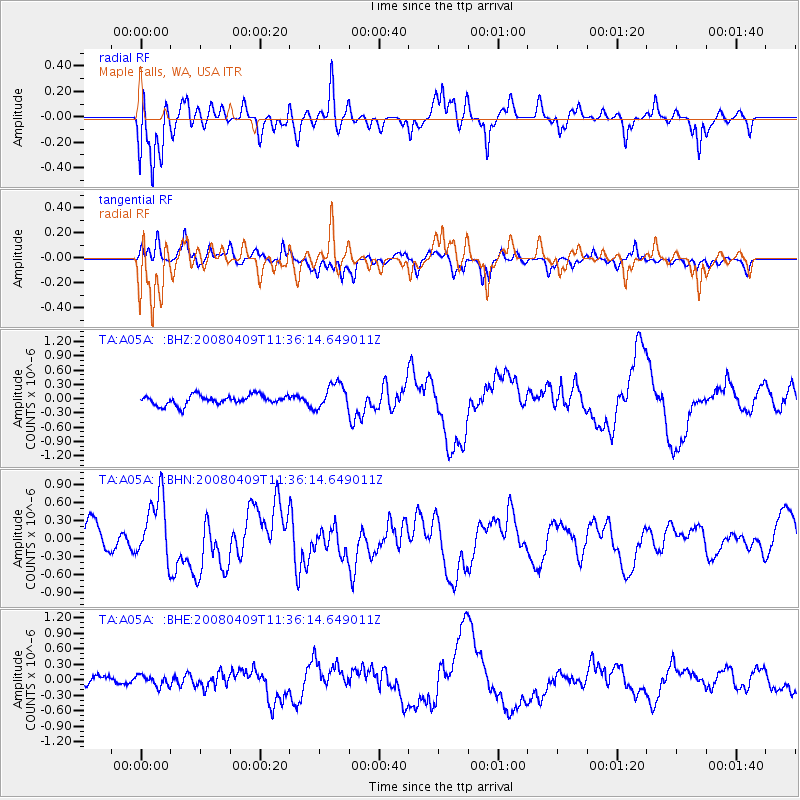
A05A Maple Falls, WA, USA - Earthquake Result Viewer
*The percent match for this event was below the threshold and hence no stack was calculated.
| Earthquake location: |
Loyalty Islands |
| Earthquake latitude/longitude: |
-20.2/168.9 |
| Earthquake time(UTC): |
2008/04/09 (100) 11:23:40 GMT |
| Earthquake Depth: |
35 km |
| Earthquake Magnitude: |
5.7 MB, 6.3 MW, 6.3 MW |
| Earthquake Catalog/Contributor: |
WHDF/NEIC |
|
| Network: |
TA USArray Transportable Network (new EarthScope stations) |
| Station: |
A05A Maple Falls, WA, USA |
| Lat/Lon: |
49.00 N/122.09 W |
| Elevation: |
174 m |
|
| Distance: |
92.1 deg |
| Az: |
37.973 deg |
| Baz: |
241.352 deg |
| Ray Param: |
$rayparam |
*The percent match for this event was below the threshold and hence was not used in the summary stack. |
|
| Radial Match: |
66.40984 % |
| Radial Bump: |
400 |
| Transverse Match: |
68.65965 % |
| Transverse Bump: |
400 |
| SOD ConfigId: |
2504 |
| Insert Time: |
2010-03-06 01:35:51.526 +0000 |
| GWidth: |
2.5 |
| Max Bumps: |
400 |
| Tol: |
0.001 |
|
Signal To Noise
| Channel | StoN | STA | LTA |
| TA:A05A: :BHN:20080409T11:36:14.649011Z | 2.4032857 | 5.4033836E-7 | 2.2483319E-7 |
| TA:A05A: :BHE:20080409T11:36:14.649011Z | 0.9772009 | 1.0408583E-7 | 1.0651426E-7 |
| TA:A05A: :BHZ:20080409T11:36:14.649011Z | 2.6196213 | 2.6742595E-7 | 1.0208573E-7 |
| Arrivals |
| Ps | |
| PpPs | |
| PsPs/PpSs | |


