You are here: Home > Network List > IU - Global Seismograph Network (GSN - IRIS/USGS) Stations List
> Station PMG Port Moresby, New Guinea > Earthquake Result Viewer
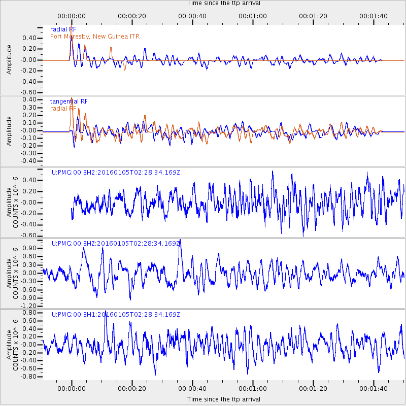
PMG Port Moresby, New Guinea - Earthquake Result Viewer
*The percent match for this event was below the threshold and hence no stack was calculated.
| Earthquake location: |
Southeast Of Shikoku, Japan |
| Earthquake latitude/longitude: |
30.6/132.8 |
| Earthquake time(UTC): |
2016/01/05 (005) 02:21:12 GMT |
| Earthquake Depth: |
10 km |
| Earthquake Magnitude: |
5.8 MB, 5.8 MWB |
| Earthquake Catalog/Contributor: |
NEIC PDE/NEIC COMCAT |
|
| Network: |
IU Global Seismograph Network (GSN - IRIS/USGS) |
| Station: |
PMG Port Moresby, New Guinea |
| Lat/Lon: |
9.40 S/147.16 E |
| Elevation: |
90 m |
|
| Distance: |
42.1 deg |
| Az: |
158.609 deg |
| Baz: |
341.423 deg |
| Ray Param: |
$rayparam |
*The percent match for this event was below the threshold and hence was not used in the summary stack. |
|
| Radial Match: |
73.18827 % |
| Radial Bump: |
400 |
| Transverse Match: |
64.56602 % |
| Transverse Bump: |
400 |
| SOD ConfigId: |
1379111 |
| Insert Time: |
2016-01-19 02:33:41.678 +0000 |
| GWidth: |
2.5 |
| Max Bumps: |
400 |
| Tol: |
0.001 |
|
Signal To Noise
| Channel | StoN | STA | LTA |
| IU:PMG:00:BHZ:20160105T02:28:34.169Z | 4.0316496 | 4.412428E-7 | 1.09444734E-7 |
| IU:PMG:00:BH1:20160105T02:28:34.169Z | 1.4617237 | 1.9827954E-7 | 1.3564775E-7 |
| IU:PMG:00:BH2:20160105T02:28:34.169Z | 1.3122668 | 1.7583366E-7 | 1.3399232E-7 |
| Arrivals |
| Ps | |
| PpPs | |
| PsPs/PpSs | |


