You are here: Home > Network List > AV - Alaska Volcano Observatory Stations List
> Station AMKA Regional Station, Amchitka Island, Alaska > Earthquake Result Viewer
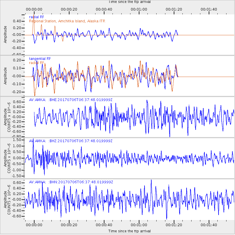
AMKA Regional Station, Amchitka Island, Alaska - Earthquake Result Viewer
*The percent match for this event was below the threshold and hence no stack was calculated.
| Earthquake location: |
Montana |
| Earthquake latitude/longitude: |
46.9/-112.6 |
| Earthquake time(UTC): |
2017/07/06 (187) 06:30:16 GMT |
| Earthquake Depth: |
4.3 km |
| Earthquake Magnitude: |
5.8 Mww |
| Earthquake Catalog/Contributor: |
NEIC PDE/us |
|
| Network: |
AV Alaska Volcano Observatory |
| Station: |
AMKA Regional Station, Amchitka Island, Alaska |
| Lat/Lon: |
51.38 N/179.30 E |
| Elevation: |
116 m |
|
| Distance: |
43.3 deg |
| Az: |
302.063 deg |
| Baz: |
68.008 deg |
| Ray Param: |
$rayparam |
*The percent match for this event was below the threshold and hence was not used in the summary stack. |
|
| Radial Match: |
50.380142 % |
| Radial Bump: |
373 |
| Transverse Match: |
47.896854 % |
| Transverse Bump: |
400 |
| SOD ConfigId: |
13570011 |
| Insert Time: |
2019-04-28 08:12:48.126 +0000 |
| GWidth: |
2.5 |
| Max Bumps: |
400 |
| Tol: |
0.001 |
|
Signal To Noise
| Channel | StoN | STA | LTA |
| AV:AMKA: :BHZ:20170706T06:37:48.019999Z | 2.5689812 | 5.980491E-7 | 2.327962E-7 |
| AV:AMKA: :BHN:20170706T06:37:48.019999Z | 1.4132324 | 2.1094905E-7 | 1.4926707E-7 |
| AV:AMKA: :BHE:20170706T06:37:48.019999Z | 1.6232296 | 3.1002418E-7 | 1.909922E-7 |
| Arrivals |
| Ps | |
| PpPs | |
| PsPs/PpSs | |


