You are here: Home > Network List > TA - USArray Transportable Network (new EarthScope stations) Stations List
> Station L15K Ungalak Mountain, AK, USA > Earthquake Result Viewer
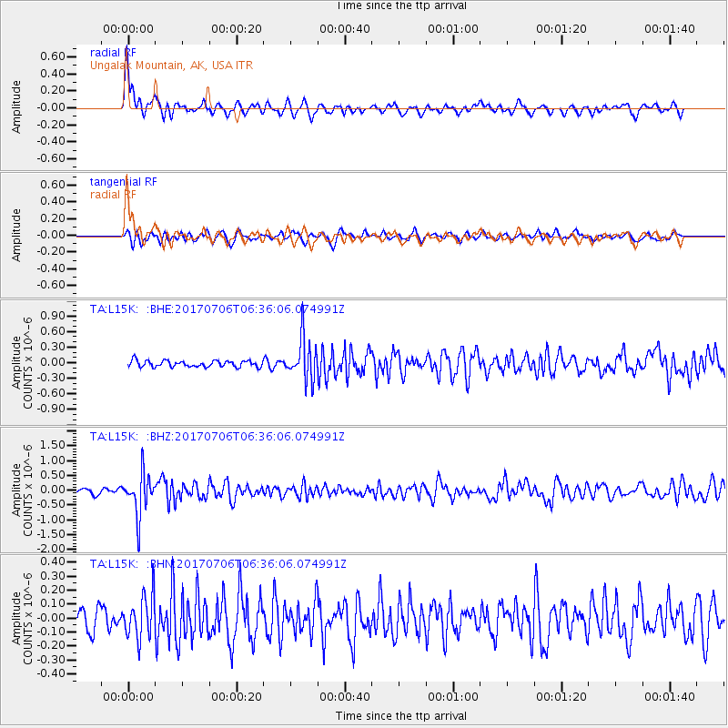
L15K Ungalak Mountain, AK, USA - Earthquake Result Viewer
*The percent match for this event was below the threshold and hence no stack was calculated.
| Earthquake location: |
Montana |
| Earthquake latitude/longitude: |
46.9/-112.6 |
| Earthquake time(UTC): |
2017/07/06 (187) 06:30:16 GMT |
| Earthquake Depth: |
4.3 km |
| Earthquake Magnitude: |
5.8 Mww |
| Earthquake Catalog/Contributor: |
NEIC PDE/us |
|
| Network: |
TA USArray Transportable Network (new EarthScope stations) |
| Station: |
L15K Ungalak Mountain, AK, USA |
| Lat/Lon: |
61.68 N/161.49 W |
| Elevation: |
219 m |
|
| Distance: |
31.3 deg |
| Az: |
316.184 deg |
| Baz: |
95.427 deg |
| Ray Param: |
$rayparam |
*The percent match for this event was below the threshold and hence was not used in the summary stack. |
|
| Radial Match: |
78.52715 % |
| Radial Bump: |
379 |
| Transverse Match: |
66.01115 % |
| Transverse Bump: |
400 |
| SOD ConfigId: |
13570011 |
| Insert Time: |
2019-04-28 08:16:12.716 +0000 |
| GWidth: |
2.5 |
| Max Bumps: |
400 |
| Tol: |
0.001 |
|
Signal To Noise
| Channel | StoN | STA | LTA |
| TA:L15K: :BHZ:20170706T06:36:06.074991Z | 7.229145 | 7.070533E-7 | 9.780594E-8 |
| TA:L15K: :BHN:20170706T06:36:06.074991Z | 2.2814302 | 1.5592285E-7 | 6.834434E-8 |
| TA:L15K: :BHE:20170706T06:36:06.074991Z | 6.6278152 | 4.0299406E-7 | 6.080346E-8 |
| Arrivals |
| Ps | |
| PpPs | |
| PsPs/PpSs | |


