You are here: Home > Network List > TJ - Tajikistan National Seismic Network Stations List
> Station GARM Garm, Tajikistan > Earthquake Result Viewer
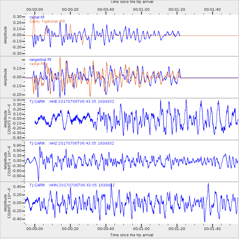
GARM Garm, Tajikistan - Earthquake Result Viewer
*The percent match for this event was below the threshold and hence no stack was calculated.
| Earthquake location: |
Montana |
| Earthquake latitude/longitude: |
46.9/-112.6 |
| Earthquake time(UTC): |
2017/07/06 (187) 06:30:16 GMT |
| Earthquake Depth: |
4.3 km |
| Earthquake Magnitude: |
5.8 Mww |
| Earthquake Catalog/Contributor: |
NEIC PDE/us |
|
| Network: |
TJ Tajikistan National Seismic Network |
| Station: |
GARM Garm, Tajikistan |
| Lat/Lon: |
39.00 N/70.32 E |
| Elevation: |
1305 m |
|
| Distance: |
94.4 deg |
| Az: |
357.732 deg |
| Baz: |
1.996 deg |
| Ray Param: |
$rayparam |
*The percent match for this event was below the threshold and hence was not used in the summary stack. |
|
| Radial Match: |
63.479286 % |
| Radial Bump: |
400 |
| Transverse Match: |
59.797035 % |
| Transverse Bump: |
400 |
| SOD ConfigId: |
13570011 |
| Insert Time: |
2019-04-28 08:16:26.378 +0000 |
| GWidth: |
2.5 |
| Max Bumps: |
400 |
| Tol: |
0.001 |
|
Signal To Noise
| Channel | StoN | STA | LTA |
| TJ:GARM: :HHZ:20170706T06:43:05.169993Z | 3.3459702 | 4.6825653E-7 | 1.3994641E-7 |
| TJ:GARM: :HHN:20170706T06:43:05.169993Z | 0.7902754 | 8.098076E-8 | 1.02471574E-7 |
| TJ:GARM: :HHE:20170706T06:43:05.169993Z | 1.1001542 | 9.8233286E-8 | 8.9290474E-8 |
| Arrivals |
| Ps | |
| PpPs | |
| PsPs/PpSs | |


