You are here: Home > Network List > TA - USArray Transportable Network (new EarthScope stations) Stations List
> Station E08A Dider Farm, Eltopia, WA, USA > Earthquake Result Viewer
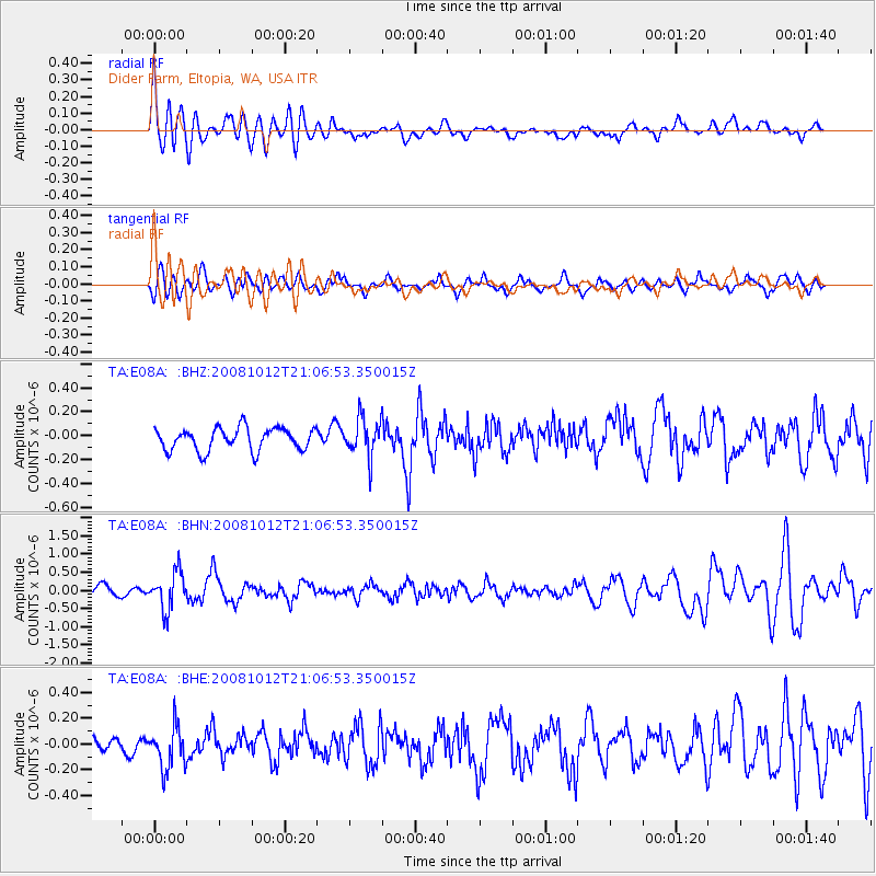
E08A Dider Farm, Eltopia, WA, USA - Earthquake Result Viewer
*The percent match for this event was below the threshold and hence no stack was calculated.
| Earthquake location: |
Southern Bolivia |
| Earthquake latitude/longitude: |
-20.1/-65.0 |
| Earthquake time(UTC): |
2008/10/12 (286) 20:55:41 GMT |
| Earthquake Depth: |
353 km |
| Earthquake Magnitude: |
6.0 MB, 6.2 MW, 6.2 MW |
| Earthquake Catalog/Contributor: |
WHDF/NEIC |
|
| Network: |
TA USArray Transportable Network (new EarthScope stations) |
| Station: |
E08A Dider Farm, Eltopia, WA, USA |
| Lat/Lon: |
46.49 N/119.06 W |
| Elevation: |
233 m |
|
| Distance: |
82.3 deg |
| Az: |
325.623 deg |
| Baz: |
129.829 deg |
| Ray Param: |
$rayparam |
*The percent match for this event was below the threshold and hence was not used in the summary stack. |
|
| Radial Match: |
69.478935 % |
| Radial Bump: |
400 |
| Transverse Match: |
57.3725 % |
| Transverse Bump: |
400 |
| SOD ConfigId: |
2560 |
| Insert Time: |
2010-03-06 01:38:50.132 +0000 |
| GWidth: |
2.5 |
| Max Bumps: |
400 |
| Tol: |
0.001 |
|
Signal To Noise
| Channel | StoN | STA | LTA |
| TA:E08A: :BHN:20081012T21:06:53.350015Z | 3.5677602 | 5.0603205E-7 | 1.4183466E-7 |
| TA:E08A: :BHE:20081012T21:06:53.350015Z | 2.9039526 | 1.6698165E-7 | 5.7501506E-8 |
| TA:E08A: :BHZ:20081012T21:06:53.350015Z | 1.70136 | 1.6031716E-7 | 9.4228824E-8 |
| Arrivals |
| Ps | |
| PpPs | |
| PsPs/PpSs | |


