You are here: Home > Network List > TA - USArray Transportable Network (new EarthScope stations) Stations List
> Station T30A Plains, KS, USA > Earthquake Result Viewer
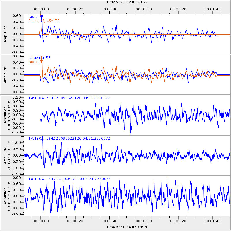
T30A Plains, KS, USA - Earthquake Result Viewer
*The percent match for this event was below the threshold and hence no stack was calculated.
| Earthquake location: |
Andreanof Islands, Aleutian Is. |
| Earthquake latitude/longitude: |
51.3/-178.2 |
| Earthquake time(UTC): |
2009/06/22 (173) 19:55:24 GMT |
| Earthquake Depth: |
35 km |
| Earthquake Magnitude: |
5.6 MB, 5.6 MW, 5.6 MW |
| Earthquake Catalog/Contributor: |
WHDF/NEIC |
|
| Network: |
TA USArray Transportable Network (new EarthScope stations) |
| Station: |
T30A Plains, KS, USA |
| Lat/Lon: |
37.05 N/100.53 W |
| Elevation: |
778 m |
|
| Distance: |
55.0 deg |
| Az: |
72.665 deg |
| Baz: |
311.457 deg |
| Ray Param: |
$rayparam |
*The percent match for this event was below the threshold and hence was not used in the summary stack. |
|
| Radial Match: |
57.090992 % |
| Radial Bump: |
400 |
| Transverse Match: |
48.85803 % |
| Transverse Bump: |
400 |
| SOD ConfigId: |
2648 |
| Insert Time: |
2010-03-06 01:40:21.355 +0000 |
| GWidth: |
2.5 |
| Max Bumps: |
400 |
| Tol: |
0.001 |
|
Signal To Noise
| Channel | StoN | STA | LTA |
| TA:T30A: :BHZ:20090622T20:04:21.225007Z | 3.0983062 | 4.5553486E-7 | 1.4702707E-7 |
| TA:T30A: :BHN:20090622T20:04:21.225007Z | 1.0852814 | 3.114452E-7 | 2.8697184E-7 |
| TA:T30A: :BHE:20090622T20:04:21.225007Z | 1.0926787 | 2.8062846E-7 | 2.5682613E-7 |
| Arrivals |
| Ps | |
| PpPs | |
| PsPs/PpSs | |


