S28A Manter, KS, USA - Earthquake Result Viewer
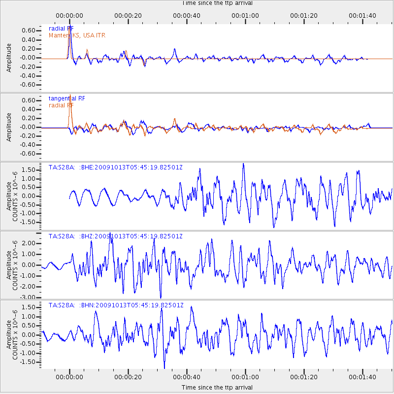
Earthquake location: Fox Islands, Aleutian Islands
Earthquake latitude/longitude: 52.8/-167.0
Earthquake time(UTC): 2009/10/13 (286) 05:37:23 GMT
Earthquake Depth: 24 km
Earthquake Magnitude: 6.0 MB, 6.1 MS, 6.5 MW, 6.5 MW
Earthquake Catalog/Contributor: WHDF/NEIC
Network: TA USArray Transportable Network (new EarthScope stations)
Station: S28A Manter, KS, USA
Lat/Lon: 37.59 N/101.90 W
Elevation: 1064 m
Distance: 46.7 deg
Az: 81.817 deg
Baz: 310.768 deg
Ray Param: 0.07043298
Estimated Moho Depth: 50.5 km
Estimated Crust Vp/Vs: 1.73
Assumed Crust Vp: 6.483 km/s
Estimated Crust Vs: 3.753 km/s
Estimated Crust Poisson's Ratio: 0.25
Radial Match: 84.96457 %
Radial Bump: 342
Transverse Match: 49.53247 %
Transverse Bump: 400
SOD ConfigId: 2622
Insert Time: 2010-03-06 01:40:52.005 +0000
GWidth: 2.5
Max Bumps: 400
Tol: 0.001

Signal To Noise

ChannelStoNSTALTA
TA:S28A: :BHZ:20091013T05:45:19.82501Z3.0618756.4753334E-72.1148261E-7
TA:S28A: :BHN:20091013T05:45:19.82501Z0.941170042.4932635E-72.6491105E-7
TA:S28A: :BHE:20091013T05:45:19.82501Z1.07867223.1038024E-72.877429E-7
Arrivals
Ps6.0 SECOND
PpPs20 SECOND
PsPs/PpSs26 SECOND