You are here: Home > Network List > CI - Caltech Regional Seismic Network Stations List
> Station DAN Danby, California, USA > Earthquake Result Viewer
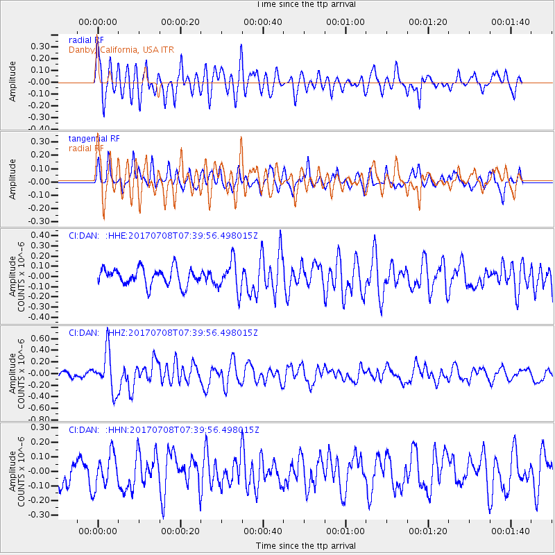
DAN Danby, California, USA - Earthquake Result Viewer
*The percent match for this event was below the threshold and hence no stack was calculated.
| Earthquake location: |
Southeast Of Loyalty Islands |
| Earthquake latitude/longitude: |
-22.6/173.1 |
| Earthquake time(UTC): |
2017/07/08 (189) 07:27:35 GMT |
| Earthquake Depth: |
10 km |
| Earthquake Magnitude: |
5.6 Mww |
| Earthquake Catalog/Contributor: |
NEIC PDE/us |
|
| Network: |
CI Caltech Regional Seismic Network |
| Station: |
DAN Danby, California, USA |
| Lat/Lon: |
34.64 N/115.38 W |
| Elevation: |
398 m |
|
| Distance: |
88.5 deg |
| Az: |
51.465 deg |
| Baz: |
241.263 deg |
| Ray Param: |
$rayparam |
*The percent match for this event was below the threshold and hence was not used in the summary stack. |
|
| Radial Match: |
69.23112 % |
| Radial Bump: |
400 |
| Transverse Match: |
55.51445 % |
| Transverse Bump: |
400 |
| SOD ConfigId: |
13570011 |
| Insert Time: |
2019-04-28 08:31:12.898 +0000 |
| GWidth: |
2.5 |
| Max Bumps: |
400 |
| Tol: |
0.001 |
|
Signal To Noise
| Channel | StoN | STA | LTA |
| CI:DAN: :HHZ:20170708T07:39:56.498015Z | 6.8634996 | 3.6054848E-7 | 5.2531288E-8 |
| CI:DAN: :HHN:20170708T07:39:56.498015Z | 1.2320166 | 1.1024591E-7 | 8.948411E-8 |
| CI:DAN: :HHE:20170708T07:39:56.498015Z | 1.8403258 | 1.5187348E-7 | 8.252532E-8 |
| Arrivals |
| Ps | |
| PpPs | |
| PsPs/PpSs | |


