You are here: Home > Network List > CI - Caltech Regional Seismic Network Stations List
> Station MPM Manuel Prospect Mine, California, USA > Earthquake Result Viewer
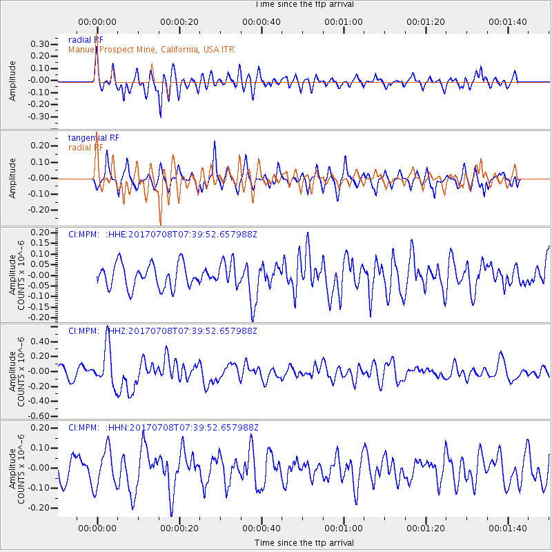
MPM Manuel Prospect Mine, California, USA - Earthquake Result Viewer
*The percent match for this event was below the threshold and hence no stack was calculated.
| Earthquake location: |
Southeast Of Loyalty Islands |
| Earthquake latitude/longitude: |
-22.6/173.1 |
| Earthquake time(UTC): |
2017/07/08 (189) 07:27:35 GMT |
| Earthquake Depth: |
10 km |
| Earthquake Magnitude: |
5.6 Mww |
| Earthquake Catalog/Contributor: |
NEIC PDE/us |
|
| Network: |
CI Caltech Regional Seismic Network |
| Station: |
MPM Manuel Prospect Mine, California, USA |
| Lat/Lon: |
36.06 N/117.49 W |
| Elevation: |
185 m |
|
| Distance: |
87.7 deg |
| Az: |
49.383 deg |
| Baz: |
239.98 deg |
| Ray Param: |
$rayparam |
*The percent match for this event was below the threshold and hence was not used in the summary stack. |
|
| Radial Match: |
63.442028 % |
| Radial Bump: |
400 |
| Transverse Match: |
54.87049 % |
| Transverse Bump: |
327 |
| SOD ConfigId: |
13570011 |
| Insert Time: |
2019-04-28 08:31:25.908 +0000 |
| GWidth: |
2.5 |
| Max Bumps: |
400 |
| Tol: |
0.001 |
|
Signal To Noise
| Channel | StoN | STA | LTA |
| CI:MPM: :HHZ:20170708T07:39:52.657988Z | 4.251583 | 2.8250128E-7 | 6.6446134E-8 |
| CI:MPM: :HHN:20170708T07:39:52.657988Z | 1.7229588 | 9.60739E-8 | 5.5761E-8 |
| CI:MPM: :HHE:20170708T07:39:52.657988Z | 1.062786 | 5.8868967E-8 | 5.5391176E-8 |
| Arrivals |
| Ps | |
| PpPs | |
| PsPs/PpSs | |


