You are here: Home > Network List > CI - Caltech Regional Seismic Network Stations List
> Station SMM Simmler, CA, USA > Earthquake Result Viewer
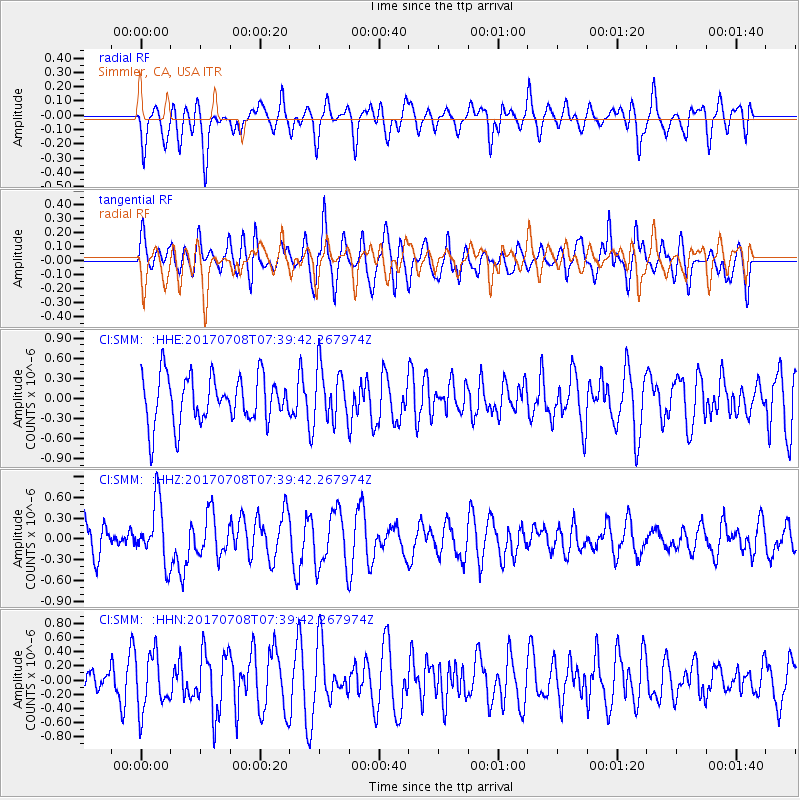
SMM Simmler, CA, USA - Earthquake Result Viewer
*The percent match for this event was below the threshold and hence no stack was calculated.
| Earthquake location: |
Southeast Of Loyalty Islands |
| Earthquake latitude/longitude: |
-22.6/173.1 |
| Earthquake time(UTC): |
2017/07/08 (189) 07:27:35 GMT |
| Earthquake Depth: |
10 km |
| Earthquake Magnitude: |
5.6 Mww |
| Earthquake Catalog/Contributor: |
NEIC PDE/us |
|
| Network: |
CI Caltech Regional Seismic Network |
| Station: |
SMM Simmler, CA, USA |
| Lat/Lon: |
35.31 N/120.00 W |
| Elevation: |
599 m |
|
| Distance: |
85.6 deg |
| Az: |
48.977 deg |
| Baz: |
238.5 deg |
| Ray Param: |
$rayparam |
*The percent match for this event was below the threshold and hence was not used in the summary stack. |
|
| Radial Match: |
48.044197 % |
| Radial Bump: |
400 |
| Transverse Match: |
52.967945 % |
| Transverse Bump: |
400 |
| SOD ConfigId: |
13570011 |
| Insert Time: |
2019-04-28 08:31:38.382 +0000 |
| GWidth: |
2.5 |
| Max Bumps: |
400 |
| Tol: |
0.001 |
|
Signal To Noise
| Channel | StoN | STA | LTA |
| CI:SMM: :HHZ:20170708T07:39:42.267974Z | 1.9866911 | 4.4001095E-7 | 2.2147928E-7 |
| CI:SMM: :HHN:20170708T07:39:42.267974Z | 1.1791856 | 3.929457E-7 | 3.332348E-7 |
| CI:SMM: :HHE:20170708T07:39:42.267974Z | 1.1318349 | 3.973249E-7 | 3.5104495E-7 |
| Arrivals |
| Ps | |
| PpPs | |
| PsPs/PpSs | |


