You are here: Home > Network List > TA - USArray Transportable Network (new EarthScope stations) Stations List
> Station S28A Manter, KS, USA > Earthquake Result Viewer
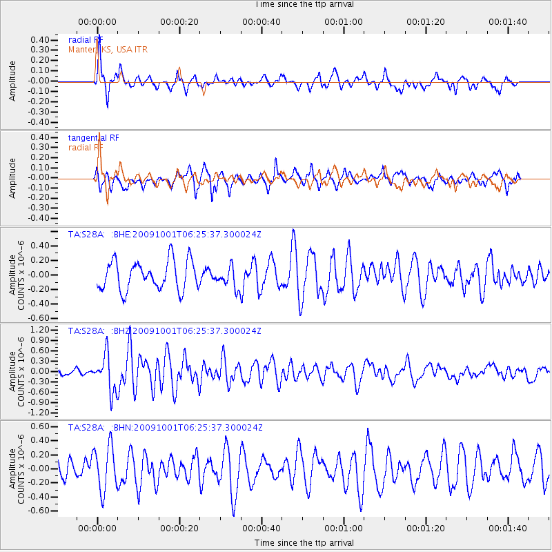
S28A Manter, KS, USA - Earthquake Result Viewer
*The percent match for this event was below the threshold and hence no stack was calculated.
| Earthquake location: |
Tonga Islands |
| Earthquake latitude/longitude: |
-15.4/-173.3 |
| Earthquake time(UTC): |
2009/10/01 (274) 06:13:32 GMT |
| Earthquake Depth: |
10 km |
| Earthquake Magnitude: |
5.6 MB, 5.7 MS, 5.8 MW, 5.7 MW |
| Earthquake Catalog/Contributor: |
WHDF/NEIC |
|
| Network: |
TA USArray Transportable Network (new EarthScope stations) |
| Station: |
S28A Manter, KS, USA |
| Lat/Lon: |
37.59 N/101.90 W |
| Elevation: |
1064 m |
|
| Distance: |
85.1 deg |
| Az: |
49.06 deg |
| Baz: |
246.532 deg |
| Ray Param: |
$rayparam |
*The percent match for this event was below the threshold and hence was not used in the summary stack. |
|
| Radial Match: |
68.39775 % |
| Radial Bump: |
386 |
| Transverse Match: |
62.08305 % |
| Transverse Bump: |
400 |
| SOD ConfigId: |
2622 |
| Insert Time: |
2010-03-06 01:41:33.645 +0000 |
| GWidth: |
2.5 |
| Max Bumps: |
400 |
| Tol: |
0.001 |
|
Signal To Noise
| Channel | StoN | STA | LTA |
| TA:S28A: :BHZ:20091001T06:25:37.300024Z | 4.507622 | 5.5460305E-7 | 1.2303673E-7 |
| TA:S28A: :BHN:20091001T06:25:37.300024Z | 1.7964791 | 3.2601892E-7 | 1.814766E-7 |
| TA:S28A: :BHE:20091001T06:25:37.300024Z | 0.7577893 | 1.5191378E-7 | 2.0046969E-7 |
| Arrivals |
| Ps | |
| PpPs | |
| PsPs/PpSs | |


