You are here: Home > Network List > TA - USArray Transportable Network (new EarthScope stations) Stations List
> Station S28A Manter, KS, USA > Earthquake Result Viewer
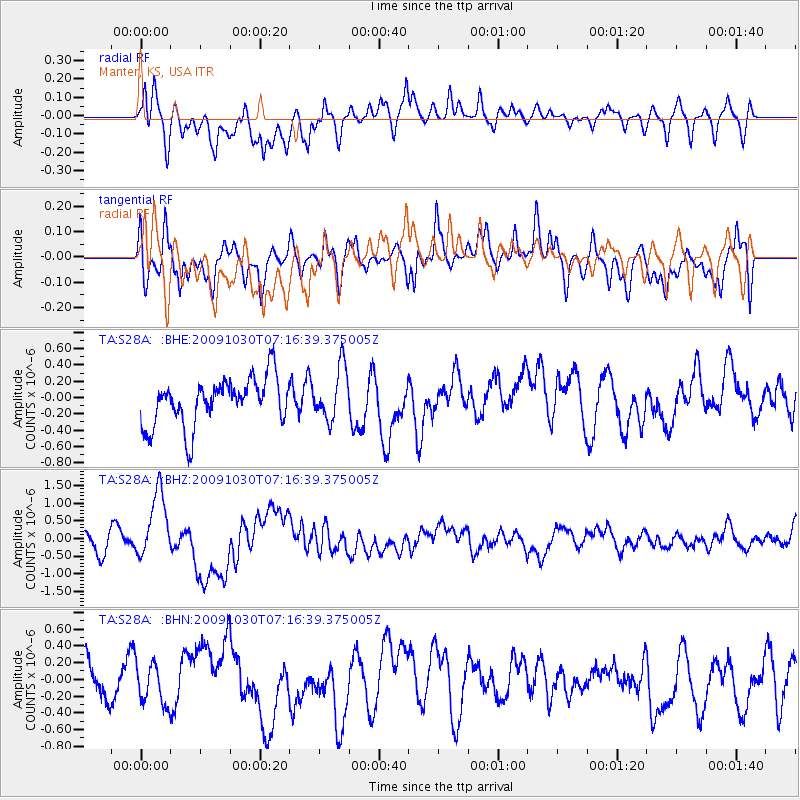
S28A Manter, KS, USA - Earthquake Result Viewer
*The percent match for this event was below the threshold and hence no stack was calculated.
| Earthquake location: |
Ryukyu Islands, Japan |
| Earthquake latitude/longitude: |
29.2/129.8 |
| Earthquake time(UTC): |
2009/10/30 (303) 07:03:39 GMT |
| Earthquake Depth: |
34 km |
| Earthquake Magnitude: |
6.3 MB, 6.8 MS, 6.8 MW, 6.8 MW |
| Earthquake Catalog/Contributor: |
WHDF/NEIC |
|
| Network: |
TA USArray Transportable Network (new EarthScope stations) |
| Station: |
S28A Manter, KS, USA |
| Lat/Lon: |
37.59 N/101.90 W |
| Elevation: |
1064 m |
|
| Distance: |
97.8 deg |
| Az: |
38.979 deg |
| Baz: |
316.194 deg |
| Ray Param: |
$rayparam |
*The percent match for this event was below the threshold and hence was not used in the summary stack. |
|
| Radial Match: |
66.78631 % |
| Radial Bump: |
400 |
| Transverse Match: |
65.360565 % |
| Transverse Bump: |
400 |
| SOD ConfigId: |
2622 |
| Insert Time: |
2010-03-06 01:41:35.267 +0000 |
| GWidth: |
2.5 |
| Max Bumps: |
400 |
| Tol: |
0.001 |
|
Signal To Noise
| Channel | StoN | STA | LTA |
| TA:S28A: :BHZ:20091030T07:16:39.375005Z | 3.8723176 | 9.403632E-7 | 2.4284248E-7 |
| TA:S28A: :BHN:20091030T07:16:39.375005Z | 1.0197711 | 2.4007016E-7 | 2.3541573E-7 |
| TA:S28A: :BHE:20091030T07:16:39.375005Z | 1.128525 | 3.2627065E-7 | 2.8911248E-7 |
| Arrivals |
| Ps | |
| PpPs | |
| PsPs/PpSs | |


