You are here: Home > Network List > TA - USArray Transportable Network (new EarthScope stations) Stations List
> Station S28A Manter, KS, USA > Earthquake Result Viewer
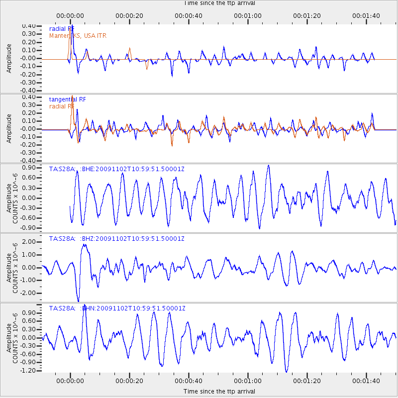
S28A Manter, KS, USA - Earthquake Result Viewer
*The percent match for this event was below the threshold and hence no stack was calculated.
| Earthquake location: |
South Of Tonga Islands |
| Earthquake latitude/longitude: |
-24.1/-175.2 |
| Earthquake time(UTC): |
2009/11/02 (306) 10:47:13 GMT |
| Earthquake Depth: |
9.0 km |
| Earthquake Magnitude: |
6.1 MB, 6.1 MS, 6.2 MW, 6.1 MW |
| Earthquake Catalog/Contributor: |
WHDF/NEIC |
|
| Network: |
TA USArray Transportable Network (new EarthScope stations) |
| Station: |
S28A Manter, KS, USA |
| Lat/Lon: |
37.59 N/101.90 W |
| Elevation: |
1064 m |
|
| Distance: |
92.2 deg |
| Az: |
49.58 deg |
| Baz: |
241.126 deg |
| Ray Param: |
$rayparam |
*The percent match for this event was below the threshold and hence was not used in the summary stack. |
|
| Radial Match: |
56.69561 % |
| Radial Bump: |
297 |
| Transverse Match: |
49.847363 % |
| Transverse Bump: |
361 |
| SOD ConfigId: |
2622 |
| Insert Time: |
2010-03-06 01:41:38.165 +0000 |
| GWidth: |
2.5 |
| Max Bumps: |
400 |
| Tol: |
0.001 |
|
Signal To Noise
| Channel | StoN | STA | LTA |
| TA:S28A: :BHZ:20091102T10:59:51.50001Z | 6.420779 | 1.3134419E-6 | 2.0456113E-7 |
| TA:S28A: :BHN:20091102T10:59:51.50001Z | 1.9662665 | 4.3833305E-7 | 2.2292656E-7 |
| TA:S28A: :BHE:20091102T10:59:51.50001Z | 0.99468386 | 4.3297797E-7 | 4.3529204E-7 |
| Arrivals |
| Ps | |
| PpPs | |
| PsPs/PpSs | |


