You are here: Home > Network List > TA - USArray Transportable Network (new EarthScope stations) Stations List
> Station G21K Allakaket, AK, USA > Earthquake Result Viewer
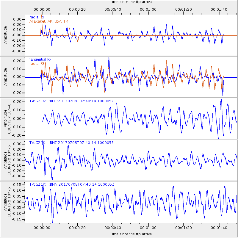
G21K Allakaket, AK, USA - Earthquake Result Viewer
*The percent match for this event was below the threshold and hence no stack was calculated.
| Earthquake location: |
Southeast Of Loyalty Islands |
| Earthquake latitude/longitude: |
-22.6/173.1 |
| Earthquake time(UTC): |
2017/07/08 (189) 07:27:35 GMT |
| Earthquake Depth: |
10 km |
| Earthquake Magnitude: |
5.6 Mww |
| Earthquake Catalog/Contributor: |
NEIC PDE/us |
|
| Network: |
TA USArray Transportable Network (new EarthScope stations) |
| Station: |
G21K Allakaket, AK, USA |
| Lat/Lon: |
66.52 N/153.51 W |
| Elevation: |
446 m |
|
| Distance: |
92.3 deg |
| Az: |
12.749 deg |
| Baz: |
210.595 deg |
| Ray Param: |
$rayparam |
*The percent match for this event was below the threshold and hence was not used in the summary stack. |
|
| Radial Match: |
52.301357 % |
| Radial Bump: |
319 |
| Transverse Match: |
55.999203 % |
| Transverse Bump: |
397 |
| SOD ConfigId: |
13570011 |
| Insert Time: |
2019-04-28 08:34:19.814 +0000 |
| GWidth: |
2.5 |
| Max Bumps: |
400 |
| Tol: |
0.001 |
|
Signal To Noise
| Channel | StoN | STA | LTA |
| TA:G21K: :BHZ:20170708T07:40:14.100005Z | 2.9198377 | 1.6613086E-7 | 5.6897296E-8 |
| TA:G21K: :BHN:20170708T07:40:14.100005Z | 1.9340782 | 7.076538E-8 | 3.6588688E-8 |
| TA:G21K: :BHE:20170708T07:40:14.100005Z | 0.6646486 | 3.0508428E-8 | 4.590159E-8 |
| Arrivals |
| Ps | |
| PpPs | |
| PsPs/PpSs | |


