You are here: Home > Network List > TA - USArray Transportable Network (new EarthScope stations) Stations List
> Station M31M Drury Creek, Yukon, CA > Earthquake Result Viewer
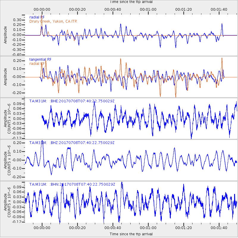
M31M Drury Creek, Yukon, CA - Earthquake Result Viewer
*The percent match for this event was below the threshold and hence no stack was calculated.
| Earthquake location: |
Southeast Of Loyalty Islands |
| Earthquake latitude/longitude: |
-22.6/173.1 |
| Earthquake time(UTC): |
2017/07/08 (189) 07:27:35 GMT |
| Earthquake Depth: |
10 km |
| Earthquake Magnitude: |
5.6 Mww |
| Earthquake Catalog/Contributor: |
NEIC PDE/us |
|
| Network: |
TA USArray Transportable Network (new EarthScope stations) |
| Station: |
M31M Drury Creek, Yukon, CA |
| Lat/Lon: |
62.20 N/134.39 W |
| Elevation: |
639 m |
|
| Distance: |
94.2 deg |
| Az: |
21.896 deg |
| Baz: |
227.327 deg |
| Ray Param: |
$rayparam |
*The percent match for this event was below the threshold and hence was not used in the summary stack. |
|
| Radial Match: |
56.149773 % |
| Radial Bump: |
325 |
| Transverse Match: |
44.769188 % |
| Transverse Bump: |
400 |
| SOD ConfigId: |
13570011 |
| Insert Time: |
2019-04-28 08:35:08.761 +0000 |
| GWidth: |
2.5 |
| Max Bumps: |
400 |
| Tol: |
0.001 |
|
Signal To Noise
| Channel | StoN | STA | LTA |
| TA:M31M: :BHZ:20170708T07:40:22.750029Z | 2.5142324 | 1.11441054E-7 | 4.4324086E-8 |
| TA:M31M: :BHN:20170708T07:40:22.750029Z | 0.88075566 | 4.302876E-8 | 4.8854364E-8 |
| TA:M31M: :BHE:20170708T07:40:22.750029Z | 1.6731311 | 4.710787E-8 | 2.8155517E-8 |
| Arrivals |
| Ps | |
| PpPs | |
| PsPs/PpSs | |


