You are here: Home > Network List > TA - USArray Transportable Network (new EarthScope stations) Stations List
> Station O18K Koktuh Hills, AK, USA > Earthquake Result Viewer
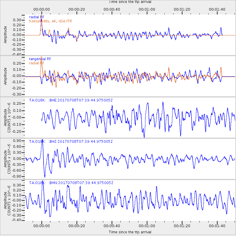
O18K Koktuh Hills, AK, USA - Earthquake Result Viewer
*The percent match for this event was below the threshold and hence no stack was calculated.
| Earthquake location: |
Southeast Of Loyalty Islands |
| Earthquake latitude/longitude: |
-22.6/173.1 |
| Earthquake time(UTC): |
2017/07/08 (189) 07:27:35 GMT |
| Earthquake Depth: |
10 km |
| Earthquake Magnitude: |
5.6 Mww |
| Earthquake Catalog/Contributor: |
NEIC PDE/us |
|
| Network: |
TA USArray Transportable Network (new EarthScope stations) |
| Station: |
O18K Koktuh Hills, AK, USA |
| Lat/Lon: |
59.85 N/155.21 W |
| Elevation: |
544 m |
|
| Distance: |
86.1 deg |
| Az: |
15.407 deg |
| Baz: |
209.111 deg |
| Ray Param: |
$rayparam |
*The percent match for this event was below the threshold and hence was not used in the summary stack. |
|
| Radial Match: |
67.350365 % |
| Radial Bump: |
400 |
| Transverse Match: |
61.44019 % |
| Transverse Bump: |
400 |
| SOD ConfigId: |
13570011 |
| Insert Time: |
2019-04-28 08:35:20.357 +0000 |
| GWidth: |
2.5 |
| Max Bumps: |
400 |
| Tol: |
0.001 |
|
Signal To Noise
| Channel | StoN | STA | LTA |
| TA:O18K: :BHZ:20170708T07:39:44.975005Z | 7.34352 | 5.238005E-7 | 7.132826E-8 |
| TA:O18K: :BHN:20170708T07:39:44.975005Z | 2.7658198 | 2.0704523E-7 | 7.485854E-8 |
| TA:O18K: :BHE:20170708T07:39:44.975005Z | 0.90395266 | 6.623695E-8 | 7.3274805E-8 |
| Arrivals |
| Ps | |
| PpPs | |
| PsPs/PpSs | |


