You are here: Home > Network List > UW - Pacific Northwest Regional Seismic Network Stations List
> Station MRBL Marblemount, WA, USA > Earthquake Result Viewer
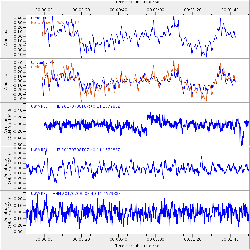
MRBL Marblemount, WA, USA - Earthquake Result Viewer
*The percent match for this event was below the threshold and hence no stack was calculated.
| Earthquake location: |
Southeast Of Loyalty Islands |
| Earthquake latitude/longitude: |
-22.6/173.1 |
| Earthquake time(UTC): |
2017/07/08 (189) 07:27:35 GMT |
| Earthquake Depth: |
10 km |
| Earthquake Magnitude: |
5.6 Mww |
| Earthquake Catalog/Contributor: |
NEIC PDE/us |
|
| Network: |
UW Pacific Northwest Regional Seismic Network |
| Station: |
MRBL Marblemount, WA, USA |
| Lat/Lon: |
48.52 N/121.48 W |
| Elevation: |
75 m |
|
| Distance: |
91.7 deg |
| Az: |
37.215 deg |
| Baz: |
237.221 deg |
| Ray Param: |
$rayparam |
*The percent match for this event was below the threshold and hence was not used in the summary stack. |
|
| Radial Match: |
71.82618 % |
| Radial Bump: |
400 |
| Transverse Match: |
73.31944 % |
| Transverse Bump: |
400 |
| SOD ConfigId: |
13570011 |
| Insert Time: |
2019-04-28 08:36:29.321 +0000 |
| GWidth: |
2.5 |
| Max Bumps: |
400 |
| Tol: |
0.001 |
|
Signal To Noise
| Channel | StoN | STA | LTA |
| UW:MRBL: :HHZ:20170708T07:40:11.157988Z | 3.5095193 | 1.822456E-7 | 5.1928936E-8 |
| UW:MRBL: :HHN:20170708T07:40:11.157988Z | 1.4927573 | 1.1404117E-7 | 7.639632E-8 |
| UW:MRBL: :HHE:20170708T07:40:11.157988Z | 1.116583 | 8.640755E-8 | 7.73857E-8 |
| Arrivals |
| Ps | |
| PpPs | |
| PsPs/PpSs | |


