You are here: Home > Network List > CN - Canadian National Seismograph Network Stations List
> Station INK INUVIK, NT > Earthquake Result Viewer
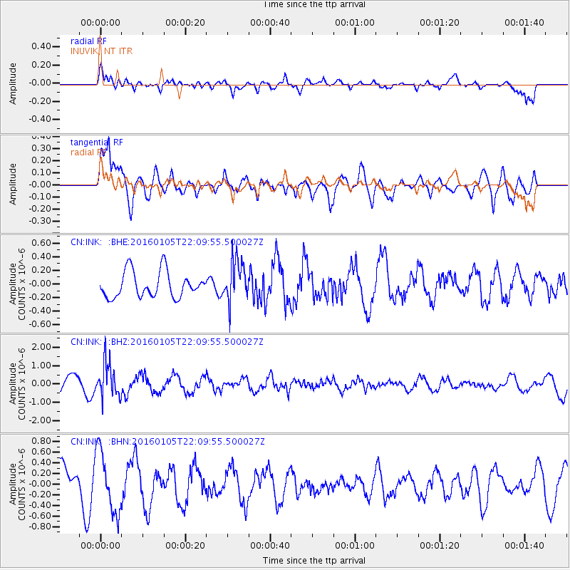
INK INUVIK, NT - Earthquake Result Viewer
*The percent match for this event was below the threshold and hence no stack was calculated.
| Earthquake location: |
Volcano Islands, Japan Region |
| Earthquake latitude/longitude: |
22.0/143.7 |
| Earthquake time(UTC): |
2016/01/05 (005) 21:59:50 GMT |
| Earthquake Depth: |
158 km |
| Earthquake Magnitude: |
5.9 MB, 5.6 MWB |
| Earthquake Catalog/Contributor: |
NEIC PDE/NEIC COMCAT |
|
| Network: |
CN Canadian National Seismograph Network |
| Station: |
INK INUVIK, NT |
| Lat/Lon: |
68.31 N/133.53 W |
| Elevation: |
44 m |
|
| Distance: |
67.1 deg |
| Az: |
23.611 deg |
| Baz: |
271.92 deg |
| Ray Param: |
$rayparam |
*The percent match for this event was below the threshold and hence was not used in the summary stack. |
|
| Radial Match: |
60.691116 % |
| Radial Bump: |
400 |
| Transverse Match: |
74.995155 % |
| Transverse Bump: |
400 |
| SOD ConfigId: |
1393891 |
| Insert Time: |
2016-01-19 22:25:01.082 +0000 |
| GWidth: |
2.5 |
| Max Bumps: |
400 |
| Tol: |
0.001 |
|
Signal To Noise
| Channel | StoN | STA | LTA |
| CN:INK: :BHZ:20160105T22:09:55.500027Z | 2.356898 | 9.39285E-7 | 3.985259E-7 |
| CN:INK: :BHN:20160105T22:09:55.500027Z | 1.8672663 | 5.780192E-7 | 3.095537E-7 |
| CN:INK: :BHE:20160105T22:09:55.500027Z | 1.6380066 | 3.0908458E-7 | 1.8869555E-7 |
| Arrivals |
| Ps | |
| PpPs | |
| PsPs/PpSs | |


