You are here: Home > Network List > TA - USArray Transportable Network (new EarthScope stations) Stations List
> Station I23K Minto, Yukon-Koyukuk, AK, USA > Earthquake Result Viewer
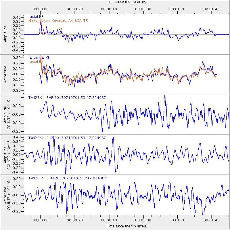
I23K Minto, Yukon-Koyukuk, AK, USA - Earthquake Result Viewer
*The percent match for this event was below the threshold and hence no stack was calculated.
| Earthquake location: |
Leyte, Philippines |
| Earthquake latitude/longitude: |
11.0/124.8 |
| Earthquake time(UTC): |
2017/07/10 (191) 01:41:48 GMT |
| Earthquake Depth: |
7.1 km |
| Earthquake Magnitude: |
5.8 Mww |
| Earthquake Catalog/Contributor: |
NEIC PDE/us |
|
| Network: |
TA USArray Transportable Network (new EarthScope stations) |
| Station: |
I23K Minto, Yukon-Koyukuk, AK, USA |
| Lat/Lon: |
65.15 N/149.36 W |
| Elevation: |
149 m |
|
| Distance: |
78.4 deg |
| Az: |
25.489 deg |
| Baz: |
270.92 deg |
| Ray Param: |
$rayparam |
*The percent match for this event was below the threshold and hence was not used in the summary stack. |
|
| Radial Match: |
44.829796 % |
| Radial Bump: |
400 |
| Transverse Match: |
50.91018 % |
| Transverse Bump: |
400 |
| SOD ConfigId: |
13570011 |
| Insert Time: |
2019-04-28 08:43:31.899 +0000 |
| GWidth: |
2.5 |
| Max Bumps: |
400 |
| Tol: |
0.001 |
|
Signal To Noise
| Channel | StoN | STA | LTA |
| TA:I23K: :BHZ:20170710T01:53:17.82498Z | 3.1706169 | 1.3023181E-7 | 4.1074596E-8 |
| TA:I23K: :BHN:20170710T01:53:17.82498Z | 0.76225144 | 5.8019676E-8 | 7.611619E-8 |
| TA:I23K: :BHE:20170710T01:53:17.82498Z | 0.9514234 | 4.850119E-8 | 5.09775E-8 |
| Arrivals |
| Ps | |
| PpPs | |
| PsPs/PpSs | |


