
S29A Ulysses, KS, USA - Earthquake Result Viewer
| ||||||||||||||||||
| ||||||||||||||||||
| ||||||||||||||||||
|
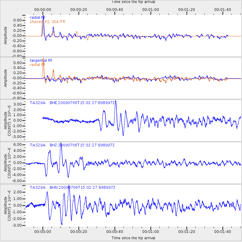
Signal To Noise
| Channel | StoN | STA | LTA |
| TA:S29A: :BHZ:20090706T15:02:27.898997Z | 12.342045 | 2.4150327E-6 | 1.9567524E-7 |
| TA:S29A: :BHN:20090706T15:02:27.898997Z | 4.8638234 | 1.1521548E-6 | 2.3688251E-7 |
| TA:S29A: :BHE:20090706T15:02:27.898997Z | 4.355208 | 1.0524127E-6 | 2.4164464E-7 |
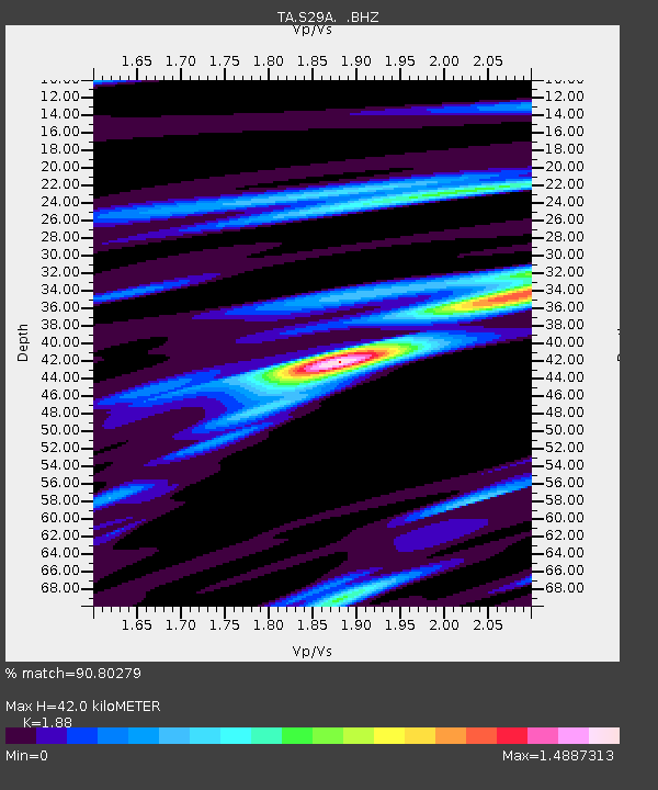
| Arrivals | |
| Ps | 6.0 SECOND |
| PpPs | 18 SECOND |
| PsPs/PpSs | 24 SECOND |

