You are here: Home > Network List > IU - Global Seismograph Network (GSN - IRIS/USGS) Stations List
> Station PMG Port Moresby, New Guinea > Earthquake Result Viewer
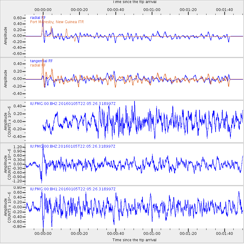
PMG Port Moresby, New Guinea - Earthquake Result Viewer
*The percent match for this event was below the threshold and hence no stack was calculated.
| Earthquake location: |
Volcano Islands, Japan Region |
| Earthquake latitude/longitude: |
22.0/143.7 |
| Earthquake time(UTC): |
2016/01/05 (005) 21:59:50 GMT |
| Earthquake Depth: |
158 km |
| Earthquake Magnitude: |
5.9 MB, 5.6 MWB |
| Earthquake Catalog/Contributor: |
NEIC PDE/NEIC COMCAT |
|
| Network: |
IU Global Seismograph Network (GSN - IRIS/USGS) |
| Station: |
PMG Port Moresby, New Guinea |
| Lat/Lon: |
9.40 S/147.16 E |
| Elevation: |
90 m |
|
| Distance: |
31.4 deg |
| Az: |
173.394 deg |
| Baz: |
353.791 deg |
| Ray Param: |
$rayparam |
*The percent match for this event was below the threshold and hence was not used in the summary stack. |
|
| Radial Match: |
59.8882 % |
| Radial Bump: |
400 |
| Transverse Match: |
49.093616 % |
| Transverse Bump: |
400 |
| SOD ConfigId: |
1393891 |
| Insert Time: |
2016-01-19 22:31:27.685 +0000 |
| GWidth: |
2.5 |
| Max Bumps: |
400 |
| Tol: |
0.001 |
|
Signal To Noise
| Channel | StoN | STA | LTA |
| IU:PMG:00:BHZ:20160105T22:05:26.318997Z | 4.8606763 | 5.230413E-7 | 1.07606695E-7 |
| IU:PMG:00:BH1:20160105T22:05:26.318997Z | 3.2067282 | 3.7965157E-7 | 1.1839219E-7 |
| IU:PMG:00:BH2:20160105T22:05:26.318997Z | 1.7323135 | 2.2022738E-7 | 1.2712906E-7 |
| Arrivals |
| Ps | |
| PpPs | |
| PsPs/PpSs | |


