You are here: Home > Network List > TA - USArray Transportable Network (new EarthScope stations) Stations List
> Station S29A Ulysses, KS, USA > Earthquake Result Viewer
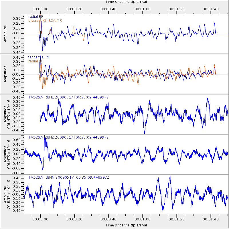
S29A Ulysses, KS, USA - Earthquake Result Viewer
*The percent match for this event was below the threshold and hence no stack was calculated.
| Earthquake location: |
Tonga Islands |
| Earthquake latitude/longitude: |
-16.8/-173.5 |
| Earthquake time(UTC): |
2009/05/17 (137) 06:23:03 GMT |
| Earthquake Depth: |
67 km |
| Earthquake Magnitude: |
5.5 MB, 5.6 MW, 5.6 MW |
| Earthquake Catalog/Contributor: |
WHDF/NEIC |
|
| Network: |
TA USArray Transportable Network (new EarthScope stations) |
| Station: |
S29A Ulysses, KS, USA |
| Lat/Lon: |
37.62 N/101.12 W |
| Elevation: |
931 m |
|
| Distance: |
86.8 deg |
| Az: |
49.283 deg |
| Baz: |
246.088 deg |
| Ray Param: |
$rayparam |
*The percent match for this event was below the threshold and hence was not used in the summary stack. |
|
| Radial Match: |
54.6243 % |
| Radial Bump: |
400 |
| Transverse Match: |
44.005493 % |
| Transverse Bump: |
400 |
| SOD ConfigId: |
2760 |
| Insert Time: |
2010-03-06 01:44:30.596 +0000 |
| GWidth: |
2.5 |
| Max Bumps: |
400 |
| Tol: |
0.001 |
|
Signal To Noise
| Channel | StoN | STA | LTA |
| TA:S29A: :BHZ:20090517T06:35:09.448997Z | 4.2974443 | 3.8627618E-7 | 8.988509E-8 |
| TA:S29A: :BHN:20090517T06:35:09.448997Z | 0.94886667 | 1.09390065E-7 | 1.1528497E-7 |
| TA:S29A: :BHE:20090517T06:35:09.448997Z | 0.8407142 | 1.1507047E-7 | 1.3687227E-7 |
| Arrivals |
| Ps | |
| PpPs | |
| PsPs/PpSs | |


