You are here: Home > Network List > TA - USArray Transportable Network (new EarthScope stations) Stations List
> Station S29A Ulysses, KS, USA > Earthquake Result Viewer
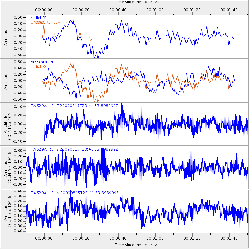
S29A Ulysses, KS, USA - Earthquake Result Viewer
*The percent match for this event was below the threshold and hence no stack was calculated.
| Earthquake location: |
Fiji Islands Region |
| Earthquake latitude/longitude: |
-19.8/-178.2 |
| Earthquake time(UTC): |
2009/08/15 (227) 23:30:19 GMT |
| Earthquake Depth: |
608 km |
| Earthquake Magnitude: |
5.6 MW, 5.2 MB |
| Earthquake Catalog/Contributor: |
WHDF/NEIC |
|
| Network: |
TA USArray Transportable Network (new EarthScope stations) |
| Station: |
S29A Ulysses, KS, USA |
| Lat/Lon: |
37.62 N/101.12 W |
| Elevation: |
931 m |
|
| Distance: |
92.2 deg |
| Az: |
50.773 deg |
| Baz: |
246.699 deg |
| Ray Param: |
$rayparam |
*The percent match for this event was below the threshold and hence was not used in the summary stack. |
|
| Radial Match: |
41.069675 % |
| Radial Bump: |
400 |
| Transverse Match: |
27.115585 % |
| Transverse Bump: |
400 |
| SOD ConfigId: |
2622 |
| Insert Time: |
2010-03-06 01:44:34.641 +0000 |
| GWidth: |
2.5 |
| Max Bumps: |
400 |
| Tol: |
0.001 |
|
Signal To Noise
| Channel | StoN | STA | LTA |
| TA:S29A: :BHZ:20090815T23:41:53.898999Z | 1.26231 | 1.2569967E-7 | 9.9579076E-8 |
| TA:S29A: :BHN:20090815T23:41:53.898999Z | 1.5047809 | 2.1544652E-7 | 1.4317467E-7 |
| TA:S29A: :BHE:20090815T23:41:53.898999Z | 0.9445255 | 1.0909522E-7 | 1.15502665E-7 |
| Arrivals |
| Ps | |
| PpPs | |
| PsPs/PpSs | |


