You are here: Home > Network List > TA - USArray Transportable Network (new EarthScope stations) Stations List
> Station S29A Ulysses, KS, USA > Earthquake Result Viewer
S29A Ulysses, KS, USA - Earthquake Result Viewer
*The percent match for this event was below the threshold and hence no stack was calculated.
| Earthquake location: |
Tonga Islands |
| Earthquake latitude/longitude: |
-15.6/-173.4 |
| Earthquake time(UTC): |
2009/09/29 (272) 23:11:51 GMT |
| Earthquake Depth: |
10 km |
| Earthquake Magnitude: |
5.5 MB |
| Earthquake Catalog/Contributor: |
WHDF/NEIC |
|
| Network: |
TA USArray Transportable Network (new EarthScope stations) |
| Station: |
S29A Ulysses, KS, USA |
| Lat/Lon: |
37.62 N/101.12 W |
| Elevation: |
931 m |
|
| Distance: |
85.9 deg |
| Az: |
49.303 deg |
| Baz: |
246.934 deg |
| Ray Param: |
$rayparam |
*The percent match for this event was below the threshold and hence was not used in the summary stack. |
|
| Radial Match: |
51.69793 % |
| Radial Bump: |
400 |
| Transverse Match: |
66.021385 % |
| Transverse Bump: |
400 |
| SOD ConfigId: |
2622 |
| Insert Time: |
2010-03-06 01:44:40.209 +0000 |
| GWidth: |
2.5 |
| Max Bumps: |
400 |
| Tol: |
0.001 |
|
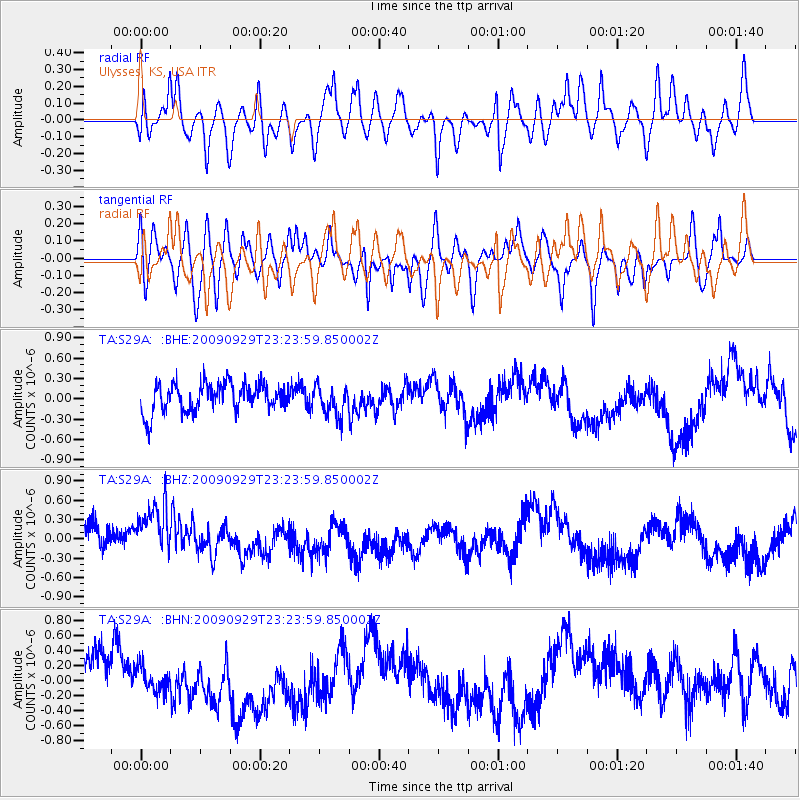
Signal To Noise
| Channel | StoN | STA | LTA |
| TA:S29A: :BHZ:20090929T23:23:59.850002Z | 1.8978555 | 5.04952E-7 | 2.6606455E-7 |
| TA:S29A: :BHN:20090929T23:23:59.850002Z | 0.60426027 | 1.6395079E-7 | 2.713248E-7 |
| TA:S29A: :BHE:20090929T23:23:59.850002Z | 1.1141163 | 2.313501E-7 | 2.0765346E-7 |
| Arrivals |
| Ps | |
| PpPs | |
| PsPs/PpSs | |


