
S30A Montezuma, KS, USA - Earthquake Result Viewer
| ||||||||||||||||||
| ||||||||||||||||||
| ||||||||||||||||||
|
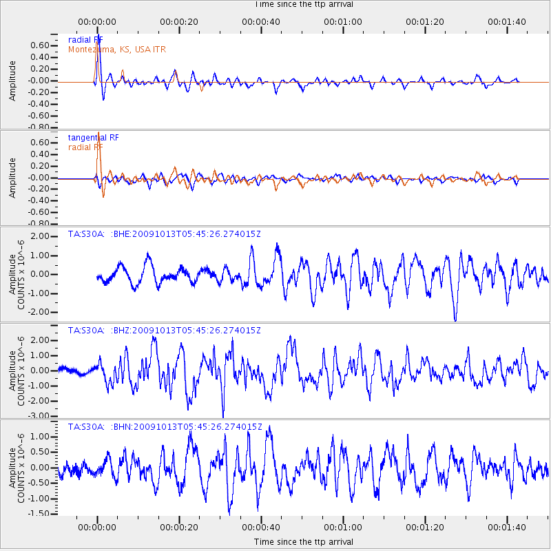
Signal To Noise
| Channel | StoN | STA | LTA |
| TA:S30A: :BHZ:20091013T05:45:26.274015Z | 2.531627 | 6.2345293E-7 | 2.4626573E-7 |
| TA:S30A: :BHN:20091013T05:45:26.274015Z | 1.329666 | 2.7988375E-7 | 2.1049176E-7 |
| TA:S30A: :BHE:20091013T05:45:26.274015Z | 0.7268573 | 2.9849218E-7 | 4.1066136E-7 |
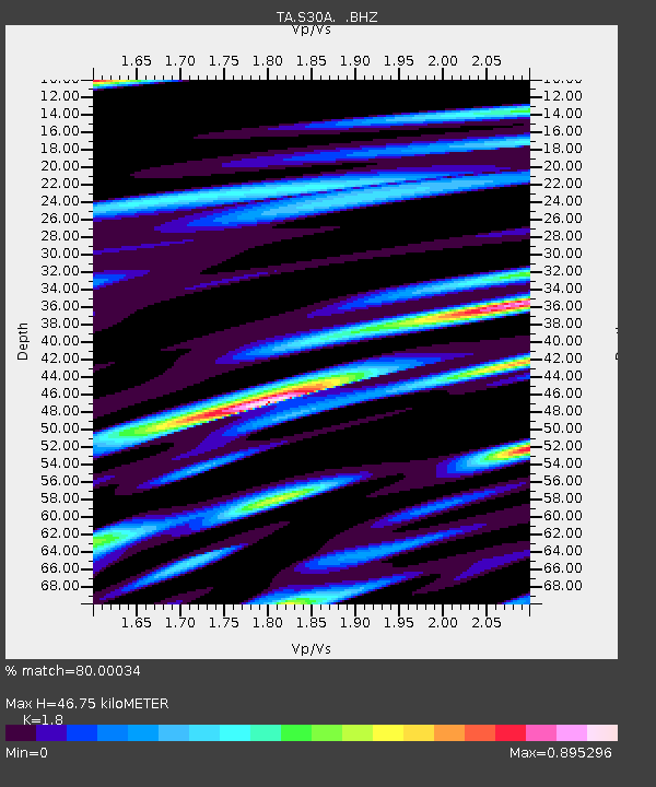
| Arrivals | |
| Ps | 6.1 SECOND |
| PpPs | 19 SECOND |
| PsPs/PpSs | 25 SECOND |

