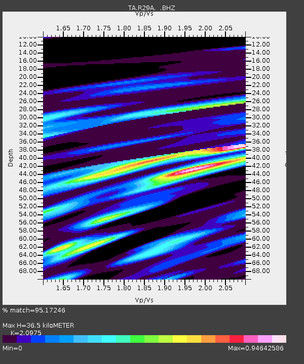
R29A Marienthal, KS, USA - Earthquake Result Viewer
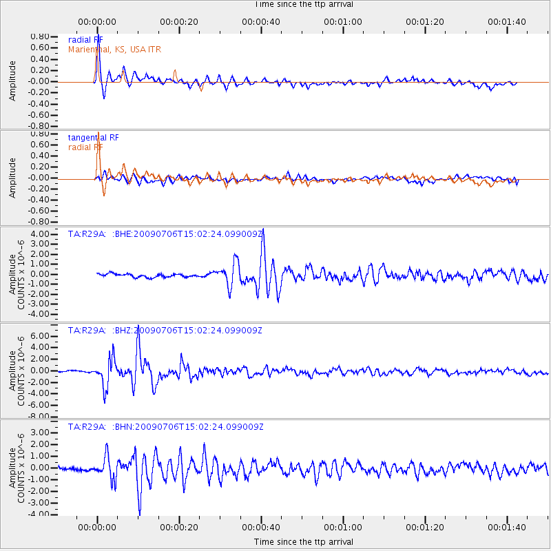
Earthquake location: Rat Islands, Aleutian Islands
Earthquake latitude/longitude: 50.4/177.0
Earthquake time(UTC): 2009/07/06 (187) 14:53:12 GMT
Earthquake Depth: 22 km
Earthquake Magnitude: 6.0 MB, 5.8 MS, 6.1 MW, 6.0 MW
Earthquake Catalog/Contributor: WHDF/NEIC
Network: TA USArray Transportable Network (new EarthScope stations)
Station: R29A Marienthal, KS, USA
Lat/Lon: 38.42 N/101.14 W
Elevation: 957 m
Distance: 56.8 deg
Az: 68.239 deg
Baz: 310.874 deg
Ray Param: 0.06384398
Estimated Moho Depth: 36.5 km
Estimated Crust Vp/Vs: 2.10
Assumed Crust Vp: 6.483 km/s
Estimated Crust Vs: 3.091 km/s
Estimated Crust Poisson's Ratio: 0.35
Radial Match: 95.17246 %
Radial Bump: 360
Transverse Match: 86.366394 %
Transverse Bump: 400
SOD ConfigId: 2648
Insert Time: 2010-03-06 01:46:52.562 +0000
GWidth: 2.5
Max Bumps: 400
Tol: 0.001

Signal To Noise

ChannelStoNSTALTA
TA:R29A: :BHZ:20090706T15:02:24.099009Z14.5940152.427346E-61.6632477E-7
TA:R29A: :BHN:20090706T15:02:24.099009Z6.5580089.696589E-71.4785874E-7
TA:R29A: :BHE:20090706T15:02:24.099009Z7.32565831.1896691E-61.6239755E-7
Arrivals
Ps6.5 SECOND
PpPs17 SECOND
PsPs/PpSs23 SECOND