You are here: Home > Network List > TA - USArray Transportable Network (new EarthScope stations) Stations List
> Station R29A Marienthal, KS, USA > Earthquake Result Viewer
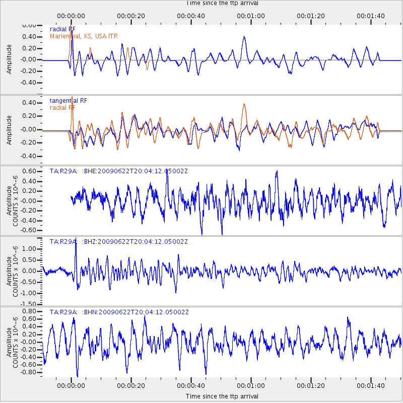
R29A Marienthal, KS, USA - Earthquake Result Viewer
*The percent match for this event was below the threshold and hence no stack was calculated.
| Earthquake location: |
Andreanof Islands, Aleutian Is. |
| Earthquake latitude/longitude: |
51.3/-178.2 |
| Earthquake time(UTC): |
2009/06/22 (173) 19:55:24 GMT |
| Earthquake Depth: |
35 km |
| Earthquake Magnitude: |
5.6 MB, 5.6 MW, 5.6 MW |
| Earthquake Catalog/Contributor: |
WHDF/NEIC |
|
| Network: |
TA USArray Transportable Network (new EarthScope stations) |
| Station: |
R29A Marienthal, KS, USA |
| Lat/Lon: |
38.42 N/101.14 W |
| Elevation: |
957 m |
|
| Distance: |
53.7 deg |
| Az: |
71.785 deg |
| Baz: |
310.571 deg |
| Ray Param: |
$rayparam |
*The percent match for this event was below the threshold and hence was not used in the summary stack. |
|
| Radial Match: |
48.39787 % |
| Radial Bump: |
399 |
| Transverse Match: |
42.474644 % |
| Transverse Bump: |
400 |
| SOD ConfigId: |
2648 |
| Insert Time: |
2010-03-06 01:47:15.867 +0000 |
| GWidth: |
2.5 |
| Max Bumps: |
400 |
| Tol: |
0.001 |
|
Signal To Noise
| Channel | StoN | STA | LTA |
| TA:R29A: :BHZ:20090622T20:04:12.05002Z | 4.699269 | 4.7531765E-7 | 1.0114715E-7 |
| TA:R29A: :BHN:20090622T20:04:12.05002Z | 1.8018745 | 3.83106E-7 | 2.1261526E-7 |
| TA:R29A: :BHE:20090622T20:04:12.05002Z | 1.4752277 | 2.4244613E-7 | 1.6434488E-7 |
| Arrivals |
| Ps | |
| PpPs | |
| PsPs/PpSs | |


