You are here: Home > Network List > TA - USArray Transportable Network (new EarthScope stations) Stations List
> Station R17K Ugashik Creek, AK, USA > Earthquake Result Viewer
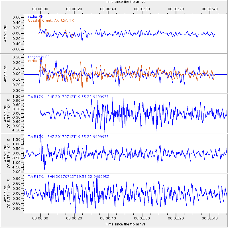
R17K Ugashik Creek, AK, USA - Earthquake Result Viewer
*The percent match for this event was below the threshold and hence no stack was calculated.
| Earthquake location: |
Sea Of Japan |
| Earthquake latitude/longitude: |
40.9/131.6 |
| Earthquake time(UTC): |
2017/07/12 (193) 19:48:07 GMT |
| Earthquake Depth: |
538 km |
| Earthquake Magnitude: |
5.8 Mww |
| Earthquake Catalog/Contributor: |
NEIC PDE/us |
|
| Network: |
TA USArray Transportable Network (new EarthScope stations) |
| Station: |
R17K Ugashik Creek, AK, USA |
| Lat/Lon: |
57.64 N/156.39 W |
| Elevation: |
273 m |
|
| Distance: |
47.5 deg |
| Az: |
43.921 deg |
| Baz: |
281.948 deg |
| Ray Param: |
$rayparam |
*The percent match for this event was below the threshold and hence was not used in the summary stack. |
|
| Radial Match: |
53.335228 % |
| Radial Bump: |
400 |
| Transverse Match: |
54.5413 % |
| Transverse Bump: |
400 |
| SOD ConfigId: |
13570011 |
| Insert Time: |
2019-04-28 09:10:42.766 +0000 |
| GWidth: |
2.5 |
| Max Bumps: |
400 |
| Tol: |
0.001 |
|
Signal To Noise
| Channel | StoN | STA | LTA |
| TA:R17K: :BHZ:20170712T19:55:22.949993Z | 3.6031098 | 8.8510217E-7 | 2.4564952E-7 |
| TA:R17K: :BHN:20170712T19:55:22.949993Z | 1.0033854 | 2.046669E-7 | 2.0397636E-7 |
| TA:R17K: :BHE:20170712T19:55:22.949993Z | 2.5237463 | 4.5312385E-7 | 1.7954413E-7 |
| Arrivals |
| Ps | |
| PpPs | |
| PsPs/PpSs | |


