You are here: Home > Network List > TJ - Tajikistan National Seismic Network Stations List
> Station GARM Garm, Tajikistan > Earthquake Result Viewer
GARM Garm, Tajikistan - Earthquake Result Viewer
*The percent match for this event was below the threshold and hence no stack was calculated.
| Earthquake location: |
Sea Of Japan |
| Earthquake latitude/longitude: |
40.9/131.6 |
| Earthquake time(UTC): |
2017/07/12 (193) 19:48:07 GMT |
| Earthquake Depth: |
538 km |
| Earthquake Magnitude: |
5.8 Mww |
| Earthquake Catalog/Contributor: |
NEIC PDE/us |
|
| Network: |
TJ Tajikistan National Seismic Network |
| Station: |
GARM Garm, Tajikistan |
| Lat/Lon: |
39.00 N/70.32 E |
| Elevation: |
1305 m |
|
| Distance: |
46.2 deg |
| Az: |
288.724 deg |
| Baz: |
67.209 deg |
| Ray Param: |
$rayparam |
*The percent match for this event was below the threshold and hence was not used in the summary stack. |
|
| Radial Match: |
76.133255 % |
| Radial Bump: |
400 |
| Transverse Match: |
71.12075 % |
| Transverse Bump: |
400 |
| SOD ConfigId: |
13570011 |
| Insert Time: |
2019-04-28 09:11:05.380 +0000 |
| GWidth: |
2.5 |
| Max Bumps: |
400 |
| Tol: |
0.001 |
|
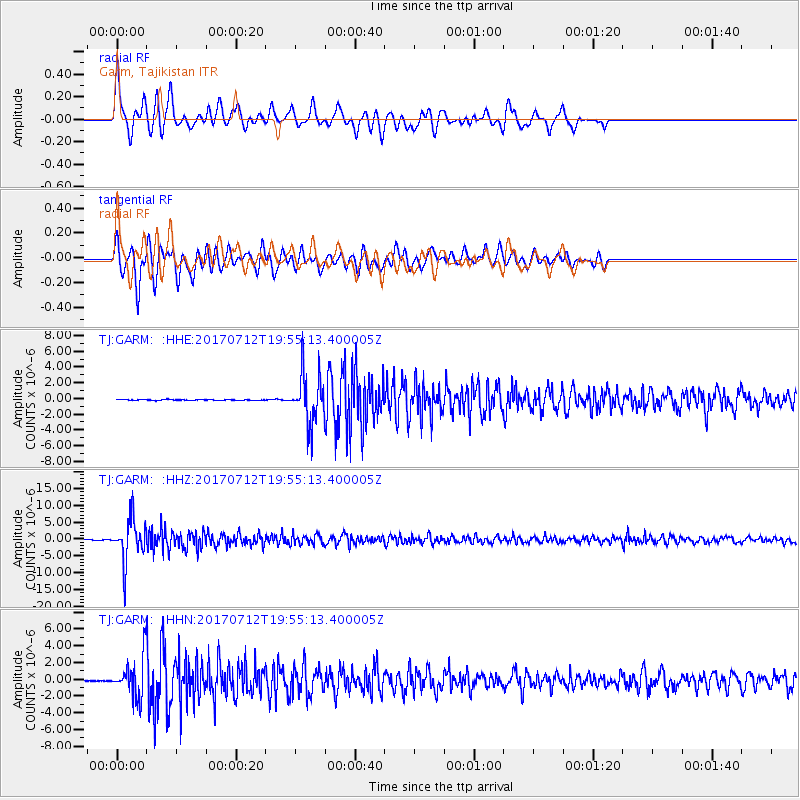
Signal To Noise
| Channel | StoN | STA | LTA |
| TJ:GARM: :HHZ:20170712T19:55:13.400005Z | 62.08378 | 6.1741907E-6 | 9.944934E-8 |
| TJ:GARM: :HHN:20170712T19:55:13.400005Z | 29.60049 | 2.3082714E-6 | 7.798085E-8 |
| TJ:GARM: :HHE:20170712T19:55:13.400005Z | 56.554035 | 3.1599259E-6 | 5.5874455E-8 |
| Arrivals |
| Ps | |
| PpPs | |
| PsPs/PpSs | |


