You are here: Home > Network List > TA - USArray Transportable Network (new EarthScope stations) Stations List
> Station MDND Maddock, ND, USA > Earthquake Result Viewer
MDND Maddock, ND, USA - Earthquake Result Viewer
*The percent match for this event was below the threshold and hence no stack was calculated.
| Earthquake location: |
Volcano Islands, Japan Region |
| Earthquake latitude/longitude: |
22.0/143.7 |
| Earthquake time(UTC): |
2016/01/05 (005) 21:59:50 GMT |
| Earthquake Depth: |
158 km |
| Earthquake Magnitude: |
5.9 MB, 5.6 MWB |
| Earthquake Catalog/Contributor: |
NEIC PDE/NEIC COMCAT |
|
| Network: |
TA USArray Transportable Network (new EarthScope stations) |
| Station: |
MDND Maddock, ND, USA |
| Lat/Lon: |
47.85 N/99.60 W |
| Elevation: |
479 m |
|
| Distance: |
90.3 deg |
| Az: |
36.987 deg |
| Baz: |
304.04 deg |
| Ray Param: |
$rayparam |
*The percent match for this event was below the threshold and hence was not used in the summary stack. |
|
| Radial Match: |
55.740337 % |
| Radial Bump: |
400 |
| Transverse Match: |
46.76754 % |
| Transverse Bump: |
400 |
| SOD ConfigId: |
1393891 |
| Insert Time: |
2016-01-19 22:43:55.890 +0000 |
| GWidth: |
2.5 |
| Max Bumps: |
400 |
| Tol: |
0.001 |
|
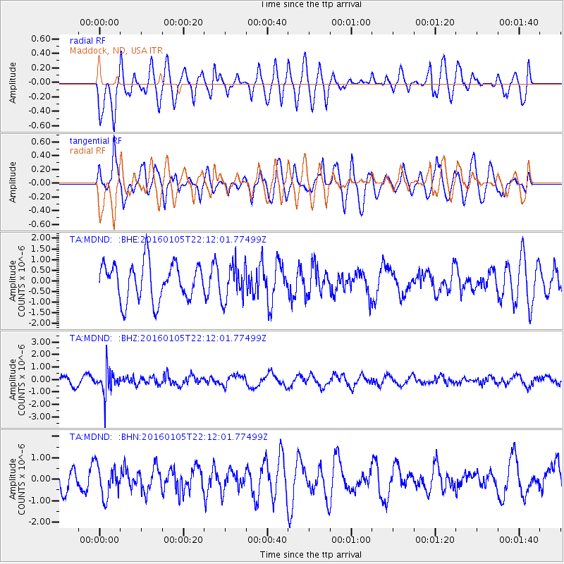
Signal To Noise
| Channel | StoN | STA | LTA |
| TA:MDND: :BHZ:20160105T22:12:01.77499Z | 2.100665 | 9.914129E-7 | 4.719519E-7 |
| TA:MDND: :BHN:20160105T22:12:01.77499Z | 1.0428321 | 7.1895636E-7 | 6.8942677E-7 |
| TA:MDND: :BHE:20160105T22:12:01.77499Z | 0.9682578 | 8.479479E-7 | 8.75746E-7 |
| Arrivals |
| Ps | |
| PpPs | |
| PsPs/PpSs | |


