You are here: Home > Network List > TA - USArray Transportable Network (new EarthScope stations) Stations List
> Station O03E Paynes Creek, CA, USA > Earthquake Result Viewer
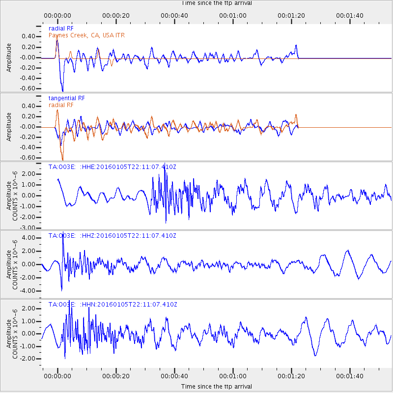
O03E Paynes Creek, CA, USA - Earthquake Result Viewer
*The percent match for this event was below the threshold and hence no stack was calculated.
| Earthquake location: |
Volcano Islands, Japan Region |
| Earthquake latitude/longitude: |
22.0/143.7 |
| Earthquake time(UTC): |
2016/01/05 (005) 21:59:50 GMT |
| Earthquake Depth: |
158 km |
| Earthquake Magnitude: |
5.9 MB, 5.6 MWB |
| Earthquake Catalog/Contributor: |
NEIC PDE/NEIC COMCAT |
|
| Network: |
TA USArray Transportable Network (new EarthScope stations) |
| Station: |
O03E Paynes Creek, CA, USA |
| Lat/Lon: |
40.29 N/121.80 W |
| Elevation: |
967 m |
|
| Distance: |
79.4 deg |
| Az: |
50.877 deg |
| Baz: |
289.782 deg |
| Ray Param: |
$rayparam |
*The percent match for this event was below the threshold and hence was not used in the summary stack. |
|
| Radial Match: |
71.70375 % |
| Radial Bump: |
400 |
| Transverse Match: |
67.46455 % |
| Transverse Bump: |
400 |
| SOD ConfigId: |
1393891 |
| Insert Time: |
2016-01-19 22:44:13.969 +0000 |
| GWidth: |
2.5 |
| Max Bumps: |
400 |
| Tol: |
0.001 |
|
Signal To Noise
| Channel | StoN | STA | LTA |
| TA:O03E: :HHZ:20160105T22:11:07.410Z | 2.5535376 | 1.561018E-6 | 6.1131584E-7 |
| TA:O03E: :HHN:20160105T22:11:07.410Z | 2.3115568 | 1.0012902E-6 | 4.3316706E-7 |
| TA:O03E: :HHE:20160105T22:11:07.410Z | 1.6233497 | 8.905146E-7 | 5.4856616E-7 |
| Arrivals |
| Ps | |
| PpPs | |
| PsPs/PpSs | |


