You are here: Home > Network List > UW - Pacific Northwest Regional Seismic Network Stations List
> Station MRBL Marblemount, WA, USA > Earthquake Result Viewer
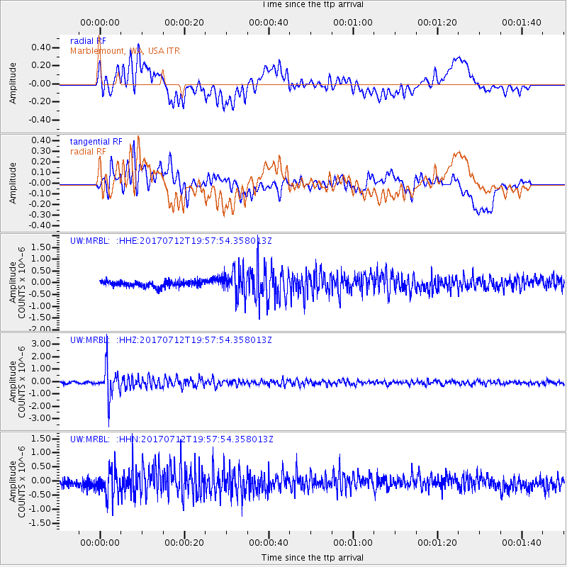
MRBL Marblemount, WA, USA - Earthquake Result Viewer
*The percent match for this event was below the threshold and hence no stack was calculated.
| Earthquake location: |
Sea Of Japan |
| Earthquake latitude/longitude: |
40.9/131.6 |
| Earthquake time(UTC): |
2017/07/12 (193) 19:48:07 GMT |
| Earthquake Depth: |
538 km |
| Earthquake Magnitude: |
5.8 Mww |
| Earthquake Catalog/Contributor: |
NEIC PDE/us |
|
| Network: |
UW Pacific Northwest Regional Seismic Network |
| Station: |
MRBL Marblemount, WA, USA |
| Lat/Lon: |
48.52 N/121.48 W |
| Elevation: |
75 m |
|
| Distance: |
70.1 deg |
| Az: |
42.579 deg |
| Baz: |
309.475 deg |
| Ray Param: |
$rayparam |
*The percent match for this event was below the threshold and hence was not used in the summary stack. |
|
| Radial Match: |
65.43062 % |
| Radial Bump: |
400 |
| Transverse Match: |
63.954704 % |
| Transverse Bump: |
400 |
| SOD ConfigId: |
13570011 |
| Insert Time: |
2019-04-28 09:11:55.480 +0000 |
| GWidth: |
2.5 |
| Max Bumps: |
400 |
| Tol: |
0.001 |
|
Signal To Noise
| Channel | StoN | STA | LTA |
| UW:MRBL: :HHZ:20170712T19:57:54.358013Z | 19.36978 | 1.2050958E-6 | 6.221525E-8 |
| UW:MRBL: :HHN:20170712T19:57:54.358013Z | 3.7765796 | 4.6112459E-7 | 1.2210111E-7 |
| UW:MRBL: :HHE:20170712T19:57:54.358013Z | 4.6033187 | 5.599833E-7 | 1.2164773E-7 |
| Arrivals |
| Ps | |
| PpPs | |
| PsPs/PpSs | |


