You are here: Home > Network List > TA - USArray Transportable Network (new EarthScope stations) Stations List
> Station S31A Mullinville, KS, USA > Earthquake Result Viewer
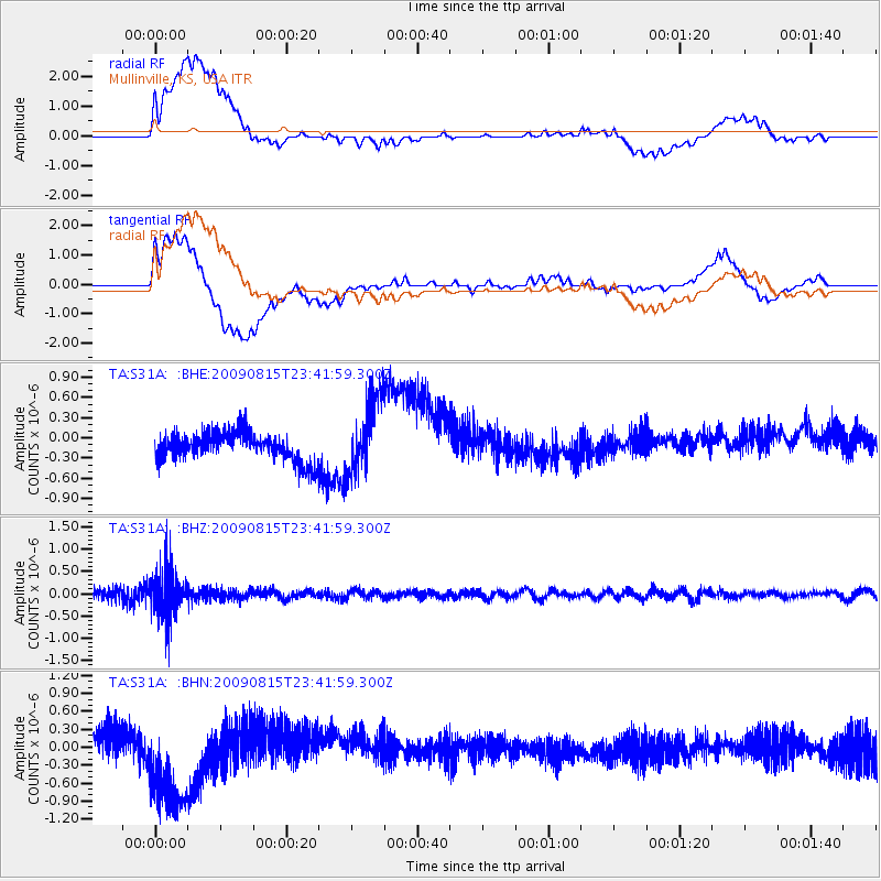
S31A Mullinville, KS, USA - Earthquake Result Viewer
*The percent match for this event was below the threshold and hence no stack was calculated.
| Earthquake location: |
Fiji Islands Region |
| Earthquake latitude/longitude: |
-19.8/-178.2 |
| Earthquake time(UTC): |
2009/08/15 (227) 23:30:19 GMT |
| Earthquake Depth: |
608 km |
| Earthquake Magnitude: |
5.6 MW, 5.2 MB |
| Earthquake Catalog/Contributor: |
WHDF/NEIC |
|
| Network: |
TA USArray Transportable Network (new EarthScope stations) |
| Station: |
S31A Mullinville, KS, USA |
| Lat/Lon: |
37.62 N/99.48 W |
| Elevation: |
700 m |
|
| Distance: |
93.4 deg |
| Az: |
51.277 deg |
| Baz: |
247.667 deg |
| Ray Param: |
$rayparam |
*The percent match for this event was below the threshold and hence was not used in the summary stack. |
|
| Radial Match: |
35.65647 % |
| Radial Bump: |
400 |
| Transverse Match: |
29.722347 % |
| Transverse Bump: |
400 |
| SOD ConfigId: |
2622 |
| Insert Time: |
2010-03-06 01:47:51.557 +0000 |
| GWidth: |
2.5 |
| Max Bumps: |
400 |
| Tol: |
0.001 |
|
Signal To Noise
| Channel | StoN | STA | LTA |
| TA:S31A: :BHZ:20090815T23:41:59.300Z | 5.9699516 | 5.1087477E-7 | 8.5574364E-8 |
| TA:S31A: :BHN:20090815T23:41:59.300Z | 5.0039644 | 8.758553E-7 | 1.7503228E-7 |
| TA:S31A: :BHE:20090815T23:41:59.300Z | 2.6967025 | 5.566674E-7 | 2.0642521E-7 |
| Arrivals |
| Ps | |
| PpPs | |
| PsPs/PpSs | |


