You are here: Home > Network List > TA - USArray Transportable Network (new EarthScope stations) Stations List
> Station S31A Mullinville, KS, USA > Earthquake Result Viewer
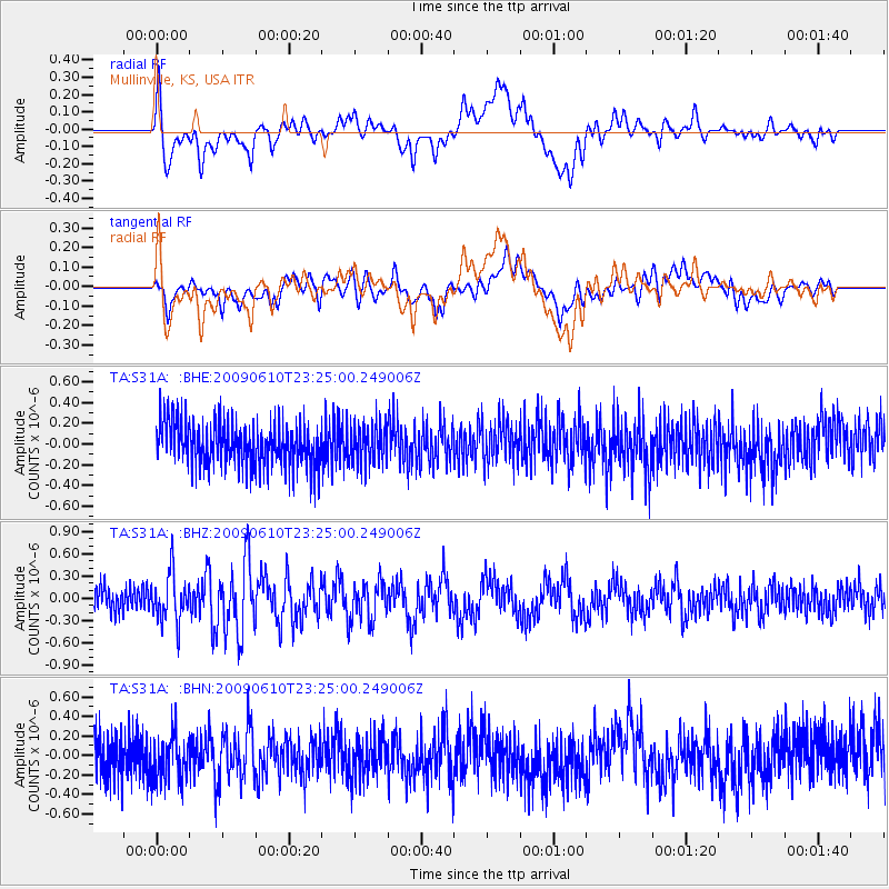
S31A Mullinville, KS, USA - Earthquake Result Viewer
*The percent match for this event was below the threshold and hence no stack was calculated.
| Earthquake location: |
West Chile Rise |
| Earthquake latitude/longitude: |
-41.7/-84.0 |
| Earthquake time(UTC): |
2009/06/10 (161) 23:13:21 GMT |
| Earthquake Depth: |
10 km |
| Earthquake Magnitude: |
5.7 MB, 5.2 MS, 5.7 MW, 5.6 MW |
| Earthquake Catalog/Contributor: |
WHDF/NEIC |
|
| Network: |
TA USArray Transportable Network (new EarthScope stations) |
| Station: |
S31A Mullinville, KS, USA |
| Lat/Lon: |
37.62 N/99.48 W |
| Elevation: |
700 m |
|
| Distance: |
80.2 deg |
| Az: |
347.573 deg |
| Baz: |
168.294 deg |
| Ray Param: |
$rayparam |
*The percent match for this event was below the threshold and hence was not used in the summary stack. |
|
| Radial Match: |
74.64751 % |
| Radial Bump: |
400 |
| Transverse Match: |
55.375988 % |
| Transverse Bump: |
400 |
| SOD ConfigId: |
2648 |
| Insert Time: |
2010-03-06 01:48:01.003 +0000 |
| GWidth: |
2.5 |
| Max Bumps: |
400 |
| Tol: |
0.001 |
|
Signal To Noise
| Channel | StoN | STA | LTA |
| TA:S31A: :BHZ:20090610T23:25:00.249006Z | 2.20395 | 3.3492148E-7 | 1.5196419E-7 |
| TA:S31A: :BHN:20090610T23:25:00.249006Z | 1.053833 | 2.359651E-7 | 2.2391129E-7 |
| TA:S31A: :BHE:20090610T23:25:00.249006Z | 0.86797667 | 1.8428324E-7 | 2.1231358E-7 |
| Arrivals |
| Ps | |
| PpPs | |
| PsPs/PpSs | |


