
R30A Dighton, KS, USA - Earthquake Result Viewer
| ||||||||||||||||||
| ||||||||||||||||||
| ||||||||||||||||||
|
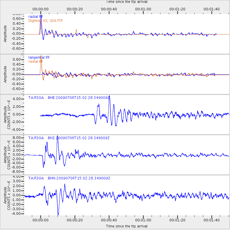
Signal To Noise
| Channel | StoN | STA | LTA |
| TA:R30A: :BHZ:20090706T15:02:28.349009Z | 13.572081 | 2.8676411E-6 | 2.1128972E-7 |
| TA:R30A: :BHN:20090706T15:02:28.349009Z | 4.868967 | 1.0286441E-6 | 2.1126536E-7 |
| TA:R30A: :BHE:20090706T15:02:28.349009Z | 6.5197086 | 1.3615593E-6 | 2.0883745E-7 |
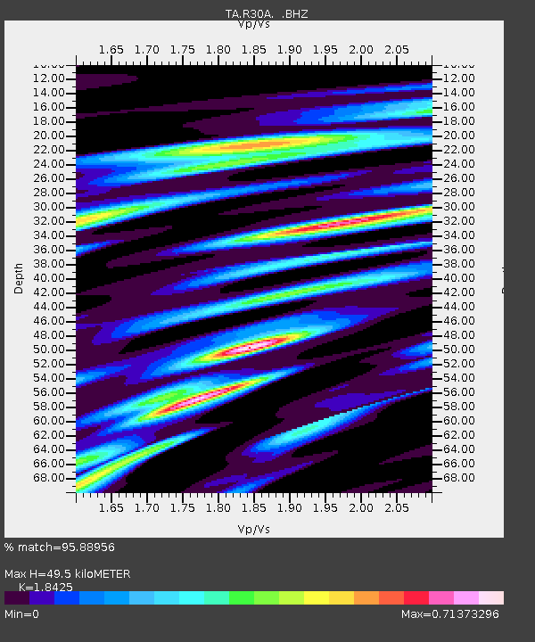
| Arrivals | |
| Ps | 6.8 SECOND |
| PpPs | 21 SECOND |
| PsPs/PpSs | 27 SECOND |

