You are here: Home > Network List > US - United States National Seismic Network Stations List
> Station EGMT Eagleton, Montana, USA > Earthquake Result Viewer
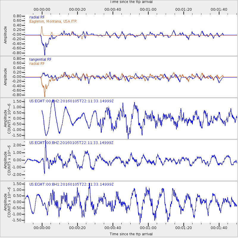
EGMT Eagleton, Montana, USA - Earthquake Result Viewer
*The percent match for this event was below the threshold and hence no stack was calculated.
| Earthquake location: |
Volcano Islands, Japan Region |
| Earthquake latitude/longitude: |
22.0/143.7 |
| Earthquake time(UTC): |
2016/01/05 (005) 21:59:50 GMT |
| Earthquake Depth: |
158 km |
| Earthquake Magnitude: |
5.9 MB, 5.6 MWB |
| Earthquake Catalog/Contributor: |
NEIC PDE/NEIC COMCAT |
|
| Network: |
US United States National Seismic Network |
| Station: |
EGMT Eagleton, Montana, USA |
| Lat/Lon: |
48.02 N/109.75 W |
| Elevation: |
1055 m |
|
| Distance: |
84.3 deg |
| Az: |
40.285 deg |
| Baz: |
296.673 deg |
| Ray Param: |
$rayparam |
*The percent match for this event was below the threshold and hence was not used in the summary stack. |
|
| Radial Match: |
82.401436 % |
| Radial Bump: |
400 |
| Transverse Match: |
40.64806 % |
| Transverse Bump: |
400 |
| SOD ConfigId: |
1393891 |
| Insert Time: |
2016-01-19 22:45:48.215 +0000 |
| GWidth: |
2.5 |
| Max Bumps: |
400 |
| Tol: |
0.001 |
|
Signal To Noise
| Channel | StoN | STA | LTA |
| US:EGMT:00:BHZ:20160105T22:11:33.14999Z | 1.8524314 | 8.94484E-7 | 4.8287023E-7 |
| US:EGMT:00:BH1:20160105T22:11:33.14999Z | 1.2681911 | 4.1134402E-7 | 3.2435491E-7 |
| US:EGMT:00:BH2:20160105T22:11:33.14999Z | 0.7821133 | 5.9464276E-7 | 7.6030256E-7 |
| Arrivals |
| Ps | |
| PpPs | |
| PsPs/PpSs | |


