You are here: Home > Network List > TA - USArray Transportable Network (new EarthScope stations) Stations List
> Station R30A Dighton, KS, USA > Earthquake Result Viewer
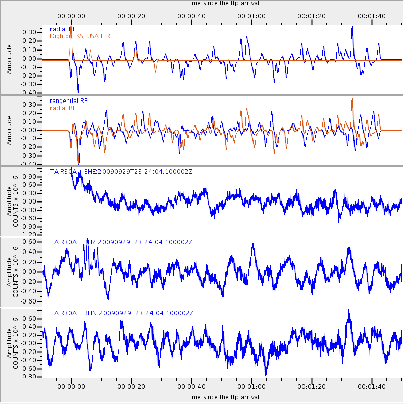
R30A Dighton, KS, USA - Earthquake Result Viewer
*The percent match for this event was below the threshold and hence no stack was calculated.
| Earthquake location: |
Tonga Islands |
| Earthquake latitude/longitude: |
-15.6/-173.4 |
| Earthquake time(UTC): |
2009/09/29 (272) 23:11:51 GMT |
| Earthquake Depth: |
10 km |
| Earthquake Magnitude: |
5.5 MB |
| Earthquake Catalog/Contributor: |
WHDF/NEIC |
|
| Network: |
TA USArray Transportable Network (new EarthScope stations) |
| Station: |
R30A Dighton, KS, USA |
| Lat/Lon: |
38.28 N/100.28 W |
| Elevation: |
776 m |
|
| Distance: |
86.8 deg |
| Az: |
48.949 deg |
| Baz: |
247.426 deg |
| Ray Param: |
$rayparam |
*The percent match for this event was below the threshold and hence was not used in the summary stack. |
|
| Radial Match: |
39.448765 % |
| Radial Bump: |
288 |
| Transverse Match: |
44.218212 % |
| Transverse Bump: |
351 |
| SOD ConfigId: |
2622 |
| Insert Time: |
2010-03-06 01:48:31.728 +0000 |
| GWidth: |
2.5 |
| Max Bumps: |
400 |
| Tol: |
0.001 |
|
Signal To Noise
| Channel | StoN | STA | LTA |
| TA:R30A: :BHZ:20090929T23:24:04.100002Z | 1.3812491 | 4.5386045E-7 | 3.2858696E-7 |
| TA:R30A: :BHN:20090929T23:24:04.100002Z | 0.93955654 | 2.3377648E-7 | 2.4881575E-7 |
| TA:R30A: :BHE:20090929T23:24:04.100002Z | 0.8908324 | 3.2520563E-7 | 3.6505816E-7 |
| Arrivals |
| Ps | |
| PpPs | |
| PsPs/PpSs | |


