You are here: Home > Network List > US - United States National Seismic Network Stations List
> Station MNTX Cornudas Mountains, Texas, USA > Earthquake Result Viewer
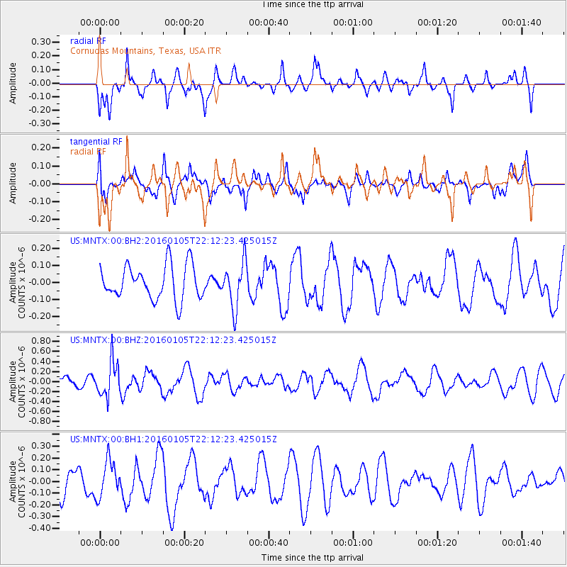
MNTX Cornudas Mountains, Texas, USA - Earthquake Result Viewer
*The percent match for this event was below the threshold and hence no stack was calculated.
| Earthquake location: |
Volcano Islands, Japan Region |
| Earthquake latitude/longitude: |
22.0/143.7 |
| Earthquake time(UTC): |
2016/01/05 (005) 21:59:50 GMT |
| Earthquake Depth: |
158 km |
| Earthquake Magnitude: |
5.9 MB, 5.6 MWB |
| Earthquake Catalog/Contributor: |
NEIC PDE/NEIC COMCAT |
|
| Network: |
US United States National Seismic Network |
| Station: |
MNTX Cornudas Mountains, Texas, USA |
| Lat/Lon: |
31.70 N/105.38 W |
| Elevation: |
404 m |
|
| Distance: |
95.0 deg |
| Az: |
53.048 deg |
| Baz: |
299.568 deg |
| Ray Param: |
$rayparam |
*The percent match for this event was below the threshold and hence was not used in the summary stack. |
|
| Radial Match: |
52.753582 % |
| Radial Bump: |
397 |
| Transverse Match: |
63.8416 % |
| Transverse Bump: |
400 |
| SOD ConfigId: |
1393891 |
| Insert Time: |
2016-01-19 22:46:11.185 +0000 |
| GWidth: |
2.5 |
| Max Bumps: |
400 |
| Tol: |
0.001 |
|
Signal To Noise
| Channel | StoN | STA | LTA |
| US:MNTX:00:BHZ:20160105T22:12:23.425015Z | 2.6675484 | 3.5592814E-7 | 1.3342893E-7 |
| US:MNTX:00:BH1:20160105T22:12:23.425015Z | 1.2411165 | 1.5385132E-7 | 1.2396202E-7 |
| US:MNTX:00:BH2:20160105T22:12:23.425015Z | 1.3761662 | 1.3912197E-7 | 1.0109386E-7 |
| Arrivals |
| Ps | |
| PpPs | |
| PsPs/PpSs | |


