You are here: Home > Network List > TA - USArray Transportable Network (new EarthScope stations) Stations List
> Station Q28A Sharon Springs, KS, USA > Earthquake Result Viewer
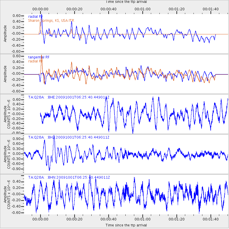
Q28A Sharon Springs, KS, USA - Earthquake Result Viewer
*The percent match for this event was below the threshold and hence no stack was calculated.
| Earthquake location: |
Tonga Islands |
| Earthquake latitude/longitude: |
-15.4/-173.3 |
| Earthquake time(UTC): |
2009/10/01 (274) 06:13:32 GMT |
| Earthquake Depth: |
10 km |
| Earthquake Magnitude: |
5.6 MB, 5.7 MS, 5.8 MW, 5.7 MW |
| Earthquake Catalog/Contributor: |
WHDF/NEIC |
|
| Network: |
TA USArray Transportable Network (new EarthScope stations) |
| Station: |
Q28A Sharon Springs, KS, USA |
| Lat/Lon: |
39.06 N/101.83 W |
| Elevation: |
1133 m |
|
| Distance: |
85.8 deg |
| Az: |
47.729 deg |
| Baz: |
246.468 deg |
| Ray Param: |
$rayparam |
*The percent match for this event was below the threshold and hence was not used in the summary stack. |
|
| Radial Match: |
66.38528 % |
| Radial Bump: |
400 |
| Transverse Match: |
55.47014 % |
| Transverse Bump: |
400 |
| SOD ConfigId: |
2622 |
| Insert Time: |
2010-03-06 01:49:39.111 +0000 |
| GWidth: |
2.5 |
| Max Bumps: |
400 |
| Tol: |
0.001 |
|
Signal To Noise
| Channel | StoN | STA | LTA |
| TA:Q28A: :BHZ:20091001T06:25:40.449011Z | 3.843074 | 3.9202538E-7 | 1.0200828E-7 |
| TA:Q28A: :BHN:20091001T06:25:40.449011Z | 1.0544938 | 2.2851607E-7 | 2.167069E-7 |
| TA:Q28A: :BHE:20091001T06:25:40.449011Z | 0.69924915 | 1.51078E-7 | 2.1605746E-7 |
| Arrivals |
| Ps | |
| PpPs | |
| PsPs/PpSs | |


