You are here: Home > Network List > TA - USArray Transportable Network (new EarthScope stations) Stations List
> Station P28A Satin Francis, KS, USA > Earthquake Result Viewer
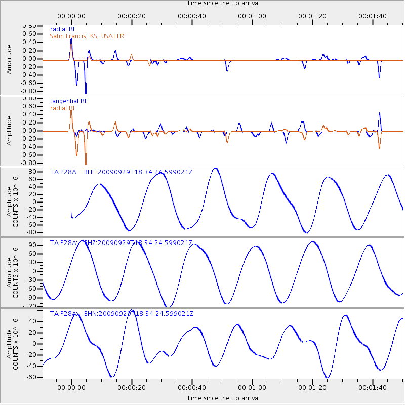
P28A Satin Francis, KS, USA - Earthquake Result Viewer
*The percent match for this event was below the threshold and hence no stack was calculated.
| Earthquake location: |
Tonga Islands |
| Earthquake latitude/longitude: |
-16.1/-173.3 |
| Earthquake time(UTC): |
2009/09/29 (272) 18:22:13 GMT |
| Earthquake Depth: |
10 km |
| Earthquake Magnitude: |
5.7 MB |
| Earthquake Catalog/Contributor: |
WHDF/NEIC |
|
| Network: |
TA USArray Transportable Network (new EarthScope stations) |
| Station: |
P28A Satin Francis, KS, USA |
| Lat/Lon: |
39.57 N/101.75 W |
| Elevation: |
1105 m |
|
| Distance: |
86.5 deg |
| Az: |
47.252 deg |
| Baz: |
245.951 deg |
| Ray Param: |
$rayparam |
*The percent match for this event was below the threshold and hence was not used in the summary stack. |
|
| Radial Match: |
94.93251 % |
| Radial Bump: |
400 |
| Transverse Match: |
63.665222 % |
| Transverse Bump: |
400 |
| SOD ConfigId: |
2622 |
| Insert Time: |
2010-03-06 01:50:41.365 +0000 |
| GWidth: |
2.5 |
| Max Bumps: |
400 |
| Tol: |
0.001 |
|
Signal To Noise
| Channel | StoN | STA | LTA |
| TA:P28A: :BHZ:20090929T18:34:24.599021Z | 1.5504247 | 9.181376E-5 | 5.9218462E-5 |
| TA:P28A: :BHN:20090929T18:34:24.599021Z | 1.8636473 | 4.998927E-5 | 2.6823353E-5 |
| TA:P28A: :BHE:20090929T18:34:24.599021Z | 1.703116 | 6.4097614E-5 | 3.7635495E-5 |
| Arrivals |
| Ps | |
| PpPs | |
| PsPs/PpSs | |


