You are here: Home > Network List > TA - USArray Transportable Network (new EarthScope stations) Stations List
> Station P28A Satin Francis, KS, USA > Earthquake Result Viewer
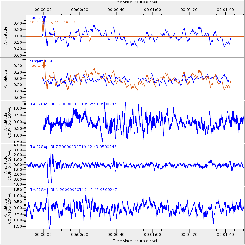
P28A Satin Francis, KS, USA - Earthquake Result Viewer
*The percent match for this event was below the threshold and hence no stack was calculated.
| Earthquake location: |
Peru-Bolivia Border Region |
| Earthquake latitude/longitude: |
-15.6/-69.3 |
| Earthquake time(UTC): |
2009/09/30 (273) 19:03:17 GMT |
| Earthquake Depth: |
255 km |
| Earthquake Magnitude: |
5.9 MB, 5.8 MW |
| Earthquake Catalog/Contributor: |
WHDF/NEIC |
|
| Network: |
TA USArray Transportable Network (new EarthScope stations) |
| Station: |
P28A Satin Francis, KS, USA |
| Lat/Lon: |
39.57 N/101.75 W |
| Elevation: |
1105 m |
|
| Distance: |
62.6 deg |
| Az: |
332.155 deg |
| Baz: |
144.375 deg |
| Ray Param: |
$rayparam |
*The percent match for this event was below the threshold and hence was not used in the summary stack. |
|
| Radial Match: |
70.07995 % |
| Radial Bump: |
400 |
| Transverse Match: |
61.075695 % |
| Transverse Bump: |
400 |
| SOD ConfigId: |
2622 |
| Insert Time: |
2010-03-06 01:50:43.426 +0000 |
| GWidth: |
2.5 |
| Max Bumps: |
400 |
| Tol: |
0.001 |
|
Signal To Noise
| Channel | StoN | STA | LTA |
| TA:P28A: :BHZ:20090930T19:12:43.950024Z | 8.890713 | 1.8986814E-6 | 2.1355783E-7 |
| TA:P28A: :BHN:20090930T19:12:43.950024Z | 2.0105588 | 8.103832E-7 | 4.0306364E-7 |
| TA:P28A: :BHE:20090930T19:12:43.950024Z | 1.99295 | 7.169159E-7 | 3.59726E-7 |
| Arrivals |
| Ps | |
| PpPs | |
| PsPs/PpSs | |


